Southeast to Jacksboro
Fort Richardson Pages
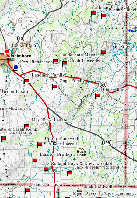
The map below shows the Texas Forts Trail from the south on 281 into Fort
Richardson. The route
runs about a quarter-mile west of Nocona's
bloody trail. If you're approaching from the south, you can take a short side trip to Black Springs (Oran), the birthplace of the real Lonesome Dove or continue on to Jacksboro.

Sul Ross, teenage son of the Fort Belknap agent, led an auxiliary force of reservation Indians across the Red River on at least one and perhaps two separate occasions to scout and fight beside Ranger and Cavalry forces in the summer of 1859. The next spring, Comanche pride was still stinging from the maulings they received north of the Red River when they viciously struck east of Jacksboro. They continued their killing and stealing spree, thereafter called Nocona's Raid, to the edge of Mineral Wells (water tower to the south) before turning back north toward Indian territory. This was a popular entrance for northern raiders to Jack and Palo Pinto settlements.
The freshly minted ranger, Captain Ross, led a batch
of local Rangers, including Charley Goodnight and a detachment of the
Second Cavalry, in pursuit of the murderers. They found and attacked
Nocona's camp on the Pease River near Eagle
Springs (Vernon) and returned victorious. Reports rapidly spread that Ross
killed Chief Nocona and Goodnight saved a blue-eyed squaw who turned
out to be the famous captive, Cynthia Ann Parker, held by the Comanches since the beginning of the Comanche
wars.
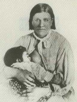 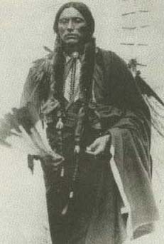
Cynthia Ann Parker with daughter, Prairie Flower. Her son, Quanah,
was just reaching his teens when she was captured. He would grow to
become principal chief of the Comanches.
Talk of the victory was soon overshadowed by news of
the shelling of Fort Sumter. The Confederacy took over the forts on the Texas frontier and in Indian territory.
Local men were organized into a frontier ranger battalion and continued
the protection of their homes. As the fortunes of war went against
the Confederates, these men had to draw straws to see who would fill
the depleted ranks on the eastern battlefields. The departed rangers
were replaced by old men and young boys.
In 1866, a small detachment of the Sixth Cavalry, led by Samuel H. "Paddy" Starr, marched into Jacksboro, established a post and began preparations to build a new fort to the north at Buffalo Springs, just across the Clay County line. The appearance of a large Comanche war party caused the army to relocate its building efforts back to the south in Jacksboro.
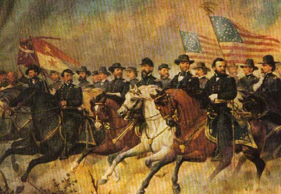
Pictured left to right are Generals Thomas Devin, George A. Custer, Judson Kilpatrick, W. H. Emory, Philip Sheridan, James B. McPherson, George Crook, Wesley Merritt, George H. Thomas, G. K. Warren, George Gordon Meade, John G. Parke, William T. Sherman, John A. Logan, U. S. Grant, Ambrose E. Burnside, Joseph Hooker and Winfield S. Hancock
The Sixth Cavalry and several infantry companies posted at Fort Richardson were woefully ineffective at pursuing raiding warriors. The army not only lacked speed but was forbidden by treaty from crossing the Red River. In fact, the forces they did occasionally manage to catch were usually much better prepared than anticipated. McClellan's defeat at the Battle of the Little Wichita is often credited to superior generalship on the part of Kiowa Chief Kicking Bird.
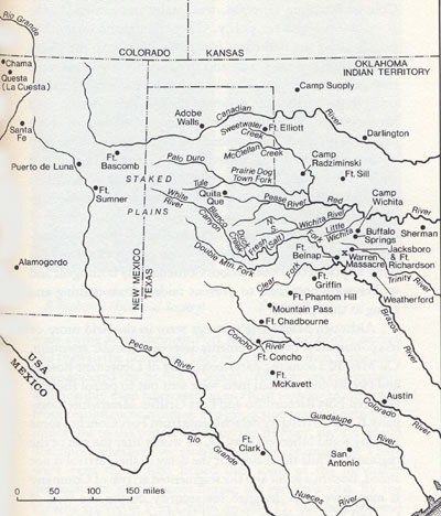
This map is from the book, Bad Hand, by Charles M. Robinson, III
Eventually the army built a third line of forts including Concho, Griffin, Richardson and Sill in Indian Territory, providing a sense of security that lured settlers back onto the frontier. Still, hundreds, if not thousands, of Comanches and Kiowas occasionally swept through the settlements.
Line of Forts
|
|
|
|
1848-1850
|
1851-1858
|
1866-1890
|
Click on thumbnails to enlarge maps.
From the book, Gone to Texas, by Randolph B. Campbell |
|


