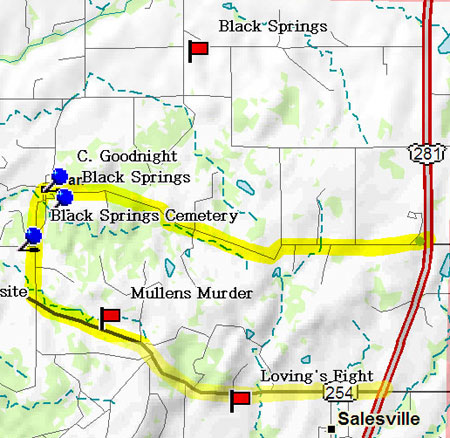
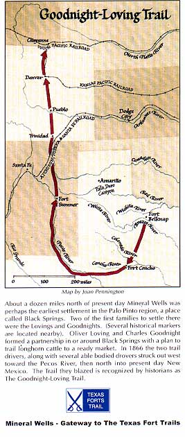
If you have time to visit the Fort Black Springs (Oran) area, Highway 52 crosses 281 on your way to Perrin. Our alternative route takes Highway 52 west to Oran where there are several historical markers in the Old Black Springs Cemetery, including one to Charles Goodnight. Follow 52 south to 254 and turn back to the west where within a quarter mile there is a roadside park, donated by Mrs. Thelma Hart, containing historical markers dedicated to pioneers Crawford Simpson and Alfred Lane. Simpson, like Goodnight, served in Cureton's Rangers who pursued and fought Nocona's band on the Pease River. A few years later, he married the widow of John Brown, whose husband was one of the victims of Nocona's raid. Alfred Lane was Goodnight's brother-in-law and a noted Ranger himself. About a mile and a half further west is the historical marker dedicated to George Rice Bevers, the first settler in what would be Palo Pinto County. Take Highway 4 north in Graford where you will soon encounter a marker dedicated to Reuben Vaughan, who built the first house in Palo Pinto County in the Fall of 1854 and whose daughter, Mollie, in August of 1855, became the first white girl born in the county. Black SpringsThe communities of Golconda (Palo Pinto), Black Springs (Oran) and Mesquiteville (Jacksboro) came into existence soon afer Fort Belknap road was completed. Eventually the ranchers produced more beef than the local market would bear. The Chisholm Trail had long been used to trail Texas cattle to Missouri and Kansas and now Loving, Goodnight and several of their neighbors pioneered trailing cattle to forts in New Mexico and Colorado, effectively the real Lonesome Dove.
|
||||
|
|
||||
|
||||


