|
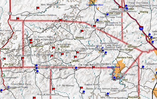
Marker Title: Bandera County
City: Bandera
County: Bandera
Year Marker Erected: 1936
Marker Location: From Bandera, take Highway 16 West about
.8 miles to roadside marker.
Marker Text: A strategic Indian point in early days. Rangers
and Comanches struggled here in 1843. In 1854 Elder Lyman Wight settled
Mormon Colony. In 1855 Poles settled here. From early days a part of
Bexar County, created and organized in 1856. Bandera, the County Seat
founded by John James, Charles de Montel and John Herndon in 1853.
Marker Title: Bandera County Courthouse
Address: 504 Main St.
County: Bandera
Year Marker Erected: 1972
Marker Location: 504 Main Street (Highway 16)
Marker Text: First permanent courthouse for county, which
was organized in 1856, but used makeshift quarters for offices and courtrooms
until this building was erected 1890-91. Style is local version of the
Second Renaissance Revival. White limestone for the structure was quarried
locally. B.F. Trester of San Antonio drew the plans--for $5. Contractors:
Ed Braden & Sons. Interior was remodeled and a wing added in 1966.
Recorded Texas Historic Landmark, 1972.
Marker Title: Bandera Pass
City: Bandera vicinity
County: Bandera
Year Marker Erected: 1936
Marker Location: From Bandera, take FM 689 north about
10 miles to intersection with Highway 16 - marker is on 173 r-o-w at
intersection.
Marker Text: Celebrated Indian pass known from the earliest
days of Spanish settlement. Identified with many a frontier fight and
many a hostile inroad. Old Ranger trail from the Medina to the Guadalupe
River and the United States Army route between frontier posts followed
this route through the mountains. More
Marker Title: Old Buck Ranch
City: Bandera vicinity
County: Bandera
Year Marker Erected: 1966
Marker Location: From Bandera, take FM 689 SE about 1
mile to Wharton's Dock Rd. & follow east about 2 miles to San Julian
Creek. (Pass Flying L. Ranch)
Marker Text: Settled 1867 by former New Yorker, Judge
Edward M. Ross, who had fought in Mexican war, then served in 1850's
at Camp Verde, army's camel post near Bandera. House is hand-cut native
stone. Daughter Kate Ross, wife of Ebenezer Buck, of a prominent pioneer
family, inherited ranch in 1901. Offering fine foods and hospitality,
the Bucks in 1920 established this as Bandera's first guest ranch, continuing
it until their deaths in 1941. Recorded Texas Historic Landmark, 1966.
Marker Title: Camp Montel, C.S.A.
Address: 504 Main St.
City: Bandera
County: Bandera
Year Marker Erected: 1964
Marker Location: courthouse grounds
Marker Text: Site 25 mi. West on Hwy. 470, 1 mi. South.
Established 1862 as part of Red River-Rio Grande defense line. Named
for Captain Charles DeMontel, surveyor and colonizer of Bandera, leader
of county defenses. Occupied by troops of Texas frontier regiment who
furnished their own guns and mounts but often lacked food, clothing
and supplies. In 1860 Bandera County's population was 399. Although
all the men were needed to defend the county from Indians, many joined
the Confederate and State troops. Some went to protect the Texas Coast
from Union invasion. Many were assigned to defend the frontier in this
region. Scouting parties and patrols managed to effectively curb Indian
raids until war's end. Texas had 2,000 miles of coastline and frontier
to defend from Union attack, Indian raids, marauders and bandits from
Mexico. Defense lines were set to give maximum protection with the few
men left in the state. One line stretched from El Paso to Brownsville.
Another, including Camp Montel, had stations a day's horseback ride
apart from Red River to Rio Grande. Former U.S. Forts used by scouting
parties lay in a line between. Behind these lines and to the east organized
militia, citizens' posses. 1964
Museum Name: Frontier Times Museum
Mailing Address: P.O. Box 1918
City: Bandera
Zip Code: 78003-1918
Street Address: 506 13th St.
Area Code: 830
Phone: 796-3864
County: Bandera
Marker Title: Captain Jack Phillips
City: Bandera
County: Bandera
Year Marker Erected: 1970
Marker Location: Corner of Main Street and Pecan Street, facing
courthouse square, Bandera.
Marker Text: A Bandera County Deputy Sheriff, Capt. Jack Phillips,
set out alone on Dec. 29, 1876, on an official visit to Sabinal Canyon.
Indians attacked him at Seco Canyon Pass, 22 miles southwest of Bandera.
Phillips raced for the nearest settlement. When his horse was shot from
under him, he ran for half a mile before being killed. A mail carrier
and a couple on their way to the county seat to be married found his
body later that day. Ironically, the Indians had been trailed for many
miles by Texas Rangers who had turned back in exhaustion just before
Phillips was waylaid. (1970, 1975)
Marker Title: Old Texas Ranger Trail
City: Bandera
County: Bandera
Year Marker Erected: 1968
Marker Location: Corner of Main Street and Pecan Street, facing
courthouse, Bandera.
Marker Text: This winding, 100-mile trail from San Antonio to
Kerrville was, during the 19th century, a strategic patrol road traveled
by Texas Rangers to protect the surrounding area from hostile Indian
attacks. During uneasy pioneer days roads such as this, regularly scouted
by Rangers, helped promote early white settlement by strengthening frontier
defense. Because Bandera was located midway on the trail and because
Bandera Pass, 10 miles north, frequently harbored Indian ambushers,
the town became a focal point for Ranger activities along the road.
Perhaps the best-known battle to occur on the old route happened in
Bandera Pass in the spring of 1841. At that time a company of 40 Texas
Rangers, under intrepid Indian fighter Capt. "Jack" Hays,
was on a scouting mission in the Guadalupe Mountains. Halfway through
the pass, they were suddenly attacked by several hundred wild Comanches
who lay hidden in the brush and behind boulders in the narrow gorge.
A bloody fight ensued, much of it hand-to-hand combat with Bowie knives;
but after their chief was slain, the Indians withdrew and finally escaped.
Thus the Rangers and this trail helped remove the Indian menace and
open the frontier across Texas. (1968)
|

