Fort McKavett: Seventeen miles west of
present day Menard
Fort McKavett
P.O. Box 867
Fort McKavett, TX 76841
Phone: 915-396-2358
Open Daily 8–5
Points of Interest
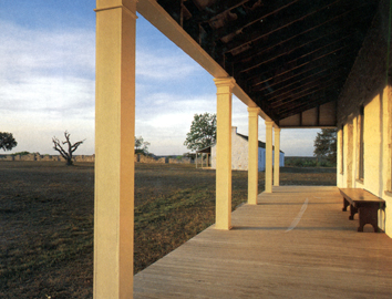
Currently, fifteen buildings have been restored, including
officers' quarters, hospital barracks, post headquarters, school house,
bakery, dead house, sink, and ruins of numerous others. Interpretive
exhibits in the old hospital ward trace the history of the Fort McKavett
area, emphasizing military history, the post-military community, and
historic archaeology.
A self-guided trail leads to the military lime kiln and
"Government Springs." Picnic tables are available for day
use.

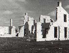
Photo of the ruined commanding officers quarters taken by Charles M. Robinson, III from the book, Frontier Forts of Texas.
Annual Events
March: Annual Re-enactment; Weapons demonstration
upon request.
This fort was established on March 14, 1852, by the United
States War Department as a protection to frontier settlers against hostile
Indians. Named in honor of Captain Henry McKavett who fell at the Battle
of Monterrey, September 21, 1842. Evacuated by Federal troops, March
22, 1859. Reoccupied April 1, 1868. Abandoned June 30, 1883.
The fort was blessed with a natural spring and lagoon,
providing it with an unending supply of water, which accounted for the
fact that unlike most posts, it regularly maintained a bountiful post
garden. Its location in the hill country provided it with an abundance
of timber and stone for construction. General Sherman once called it
"the prettiest fort on the frontier."
Indian activity in the region was not heavy during the
1850s though a brief rise in hostile raids in the spring of 1854 and
continued activity into 1855, occupied the post's companies. Comanche
chiefs Buffalo Hump, Sanaco, Ketumseh, and Yellow Wolf frequently honored
the post with a visit, but Comanches caused less trouble here than at
Fort Chadbourne during the 1850s. Military patrols and scouting parties
were regularly deployed in the field to monitor Indian activity in the
region between the Llano and Concho Rivers. In later years of the decade,
hostile Indian activity in north Texas demanded a corresponding redeployment
of troops northward. This shift resulted in the closure of Fort McKavett
in 1859. More
Communities and Related Links
|