East Texas Battle Map |
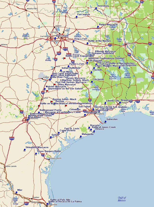
 are Historical Markers,
  are Uncommemorated Sites
Alamo | Anderson-Faulkenberry Slayings | Bastrop | Bastrop Indian Attack | Battle Creek Burial Ground (Engagement) | Battleground Prairie | Beaumont | Bird Creek Battlefield | Bird Creek Indian Battle | Bird's Fort | Box's Fort | Brazoria | Camp Victoria | Castleman's Cabin Massacre | Cincinnati | Colorado Depredations | Columbus | Crockett | Dawson Massacre | Edens-Madden Massacre | Fort Anahuac | Fort Houston | Fort Inglish | Fort Milam | Fort St. Louis | Galveston | Goliad | Harrisburg | Harvey Massacre | Houston City | Indian Battlefield | Jones Creek, Battle of | Jonesboro | Kickapoo Battlefield | Killough Massacre | King's Fort | Lacy's Fort | Liberty | Little River Fort | Little River Settler's Attack | Matagorda | Mier | Nacogdoches, Battle of | Neches, Battle of the | Palo Alto, Battle of | Parker's Fort | Post Oak Springs Massacre | Resaca de la Palma, Battle of | Richmond | Riley Massacre | Rio Blanco Battle | Ripley Massacre | Battle of the Salado | San Felipe de Austin | San Gabriel Depredation | San Jacinto Battle | Stringfield Massacre | Texas Rangers' Battle | Velasco | Webster Massacre
Alamo
Marker Title: The Alamo
Address: Alamo Plaza
City: San Antonio
County: Bexar
Year Marker Erected: 1962
Marker Location: Alamo Plaza More
Anderson-Faulkenberry Slayings
January 28th, 1837, A six man Ranger party left Fort Houston in search of hogs. They gathered some hogs and sent them back with two of the rangers. The other four spent the night and waited for the other two to return with a canoe so they could work the other side of the river. The four were attacked by Indians. Colombus Anderson was hit by the first shot and mortally wounded. David Faulkenberry was shot but yelled "C'mon boys, it's time to go." With that, all jumped in and swam across the Trinity, in spite of their wounds. One Indian tale claimed that Faulkenberry fought like a wild man, killing two Indians and wounding a third. Though wounded and scalped, he threw himself into the river and swam to the middle, where he sank out of sight. More
Early History of the City of Bastrop
Marker Title: Early History of the City of Bastrop
Address: Loop 150 and SH 21, entrance to Bastrop State Park
City: Bastrop
County: Bastrop
Year Marker Erected: 1968
Marker Location: Loop 150 and SH 21, entrance to Bastrop State Park.
Marker Text: Long before white men arrived, this region was inhabited by Tonkawa and Comanche Indians. In 1691 the first Spanish explorers crossed this territory en route to east Texas. From their route, parts of "El Camino Real" (the King's Highway) were blazed, thus placing Bastrop on a major early travel artery. Because El Camino Real crossed the Colorado River here, this was a strategic spot. In 1805 the Fort "Puesta del Colorado" and accompanying community were founded here to protect commerce on the road. In 1825 this area became "Mina," one of the first settlements in the colony of Stephen F. Austin. It was named for revolutionary leader Xavier Mina. In the years that followed, many members of its first 100 families served in the Texas Revolution (1836), the Mexican War (1846-1848), and were active in political life in the Republic and State of Texas. In 1837 when the town incorporated, the name was changed to "Bastrop" to honor the Baron de Bastrop, influential early land agent and statesman. The city was also designated county seat in 1837. (1968) From 1851-1870, this was seat of Bastrop Military Academy, an important Texas school. First courthouse was built in 1853; present one in 1883 on the same spot. (1968) More
Bastrop Indian Attack
May 14th, 1836, a band of ten to fifteen Comanches carrying a white flag approached men working in the Hornsby's field. John Williams and Howell Haggard were speared and shot down. The other men took cover and the Indians eventually decided against another attack and departed with a hundred head of cattle from the neighborhood.
Battle Creek Burial Ground
Marker Title: Battle Creek Burial Ground
Address: SH 31, W of Dawson 2 mi.
City: Dawson
County: Navarro
Year Marker Erected: 1966
Marker Location: From Dawson, go west on SH 31 about 2 miles
Marker Text: A surveying party of 25 Texans ran into about 300 Kickapoo
Indians on a buffalo hunt; failing to heed warning to leave, the Texans
were ambushed on October 8, 1838. Only seven survived, and four of these
were wounded. After the escape, they came back to bury their comrades
in a common grave. (1966) More
Battleground Prairie
Marker Title: Battleground Prairie
City: Seguin
County: Guadalupe
Year Marker Erected: 1936
Marker Location: From Seguin, take US 90A east five miles
to Marker site.
Marker Text: Where 80 volunteers commanded by General
Edward Burleson defeated Vicente Cordova and 75 Mexicans, Indians and
Negroes, March 29, 1839, and drove them from Texas, ending the "Cordova
Rebellion." 25 of the enemy were killed. Many volunteers were wounded,
but none fatally.
Beaumont
Marker Title: Beaumont
Address: 801 Main St.
City: Beaumont
County: Jefferson
Year Marker Erected: 1967
Marker Location: City Hall
Marker Text: County seat of Jefferson County. Settled in 1825 as Tevis Bluff; incorporated as Beaumont Dec. 16, 1838. Early trading post, riverboat port, lumber, rice and ranching center. Near site of Spindletop gusher, where oil became an industry, ushering in the modern port and shipyards, and a vast industrial and chemical complex.
Bird Creek Battlefield
Marker Title: Bird Creek Battlefield
City: Temple
County: Bell
Year Marker Erected: 1936
Marker Location: In median at intersection of Adams and S I-35
across from Church of Christ, Temple
Marker Text: Named in honor of Captain John Bird who lost his
life here May 26, 1839 With only 34 Texas Rangers he met 240 Indians
at this point, and routed them. More
Bird Creek Indian Battle
Marker Title: Bird Creek Indian Battle
City: Temple
County: Bell
Year Marker Erected: 1936
Marker Location: At the 2000 blk. of Nugent (inside of road),
west of I-35 and just east of Bird Creek.
Marker Text: May 26, 1839 This marker commemorates the death
of captain John Bird Sergeant William Weaver Jesse E. Nash H. M. C.
Hall Thomas Gay and the heroic and successful battle of a Ranger force
of 34 against 240 Indians. More
Site of Bird's Fort
Marker Title: Site of Bird's Fort (One Mile East)
Address: FM 157
City: Arlington
Year Marker Erected: 1980
Marker Location: FM 157, 1 mi north of Trinity River, Arlington.
Marker Text: In an effort to attract settlers to the region and to provide
protection from Indian raids, Gen. Edward H. Tarrant of the Republic
of Texas Militia authorized Jonathan Bird to establish a settlement
and military post in the area. Bird's Fort, built near a crescent-shaped
lake one mile east in 1841, was the first attempt at Anglo-American
colonization in present Tarrant County. The settlers, from the Red River
area, suffered from hunger and Indian problems and soon returned home
or joined other settlements. In August 1843, troops of the Jacob Snively
expedition disbanded at the abandoned fort, which consisted of a few
log structures. Organized to capture Mexican gold wagons on the Santa
Fe Trail in retaliation for raids of San Antonio, the outfit had been
disarmed by United States forces. About the same time, negotiations
began at the fort between Republic of Texas officials Gen. Tarrant and
Gen. George W. Terrell and the leaders of nine Indian tribes. The meetings
ended on September 29, 1843, with the signing of the Bird's Fort Treaty.
Terms of the agreement called for an end to existing conflicts and the
establishment of a line separating Indian lands from territory open
for colonization. (1980) More
Site of Bird's Fort
Marker Title: Site of Bird's Fort
Address: South Main at Silver Lake Gun Club
City: Arlington
Year Marker Erected: 1936
Marker Location: Euless, South Main, at Silver Lake Gun Club. Headquarters,
1 mile south of intersection w/ Calloway Cemetery Rd., Arlington.
Marker Text: Established in 1840 by Jonathan Bird on the Military Rd.
from Red River to Austin. In its vicinity an important Indian treaty,
marking the line between the Indians and the white settlements, was
signed September 29, 1843, by Edward H. Tarrant and George W. Terrell,
representing the Republic of Texas. The ragged remnant of the ill-fated
Snively expedition sought refuge here, August 6, 1843. (1936)
Box's Fort
Marker Title: Box's Fort
City: Alto
County: Cherokee
Year Marker Erected: 2000
Marker Location: 9 mi. W of Alto on SH 294
Marker Text: John M. and Sally Box, along with John's brother Stephen F. and his wife Keziah Box and their families, came to Texas from Alabama in 1834. John and Sally's son, Roland W. Box, and his wife Mary Hallmark Box purchased 1/3 of the Stephen Burnham land grant and built a log fort on a hill near its northern boundary. Within the enclosure they built a log house and a dugout, and Box's Fort became the center of a settlement as the extended Box families made their own homes in and near the fort. John A., Stillwell, Thomas G., and Nelson Box and their cousins Samuel C. and James E. Box fought in the Texas revolution. The home of John A. and Letty T. Box was a post office called Box's Creek from 1851 to 1866. Over time, several churches and stores operated in the vicinity, but by 1900 Box's Fort no longer appeared on area maps. (2000)
Brazoria
Marker Title: Brazoria Townsite
City: Brazoria
County: Brazoria
Year Marker Erected: 1964
Marker Location: intersection of Travis and Market, in front of county warehouse
Marker Text: Established 1828 by John Austin, friend of Stephen F. Austin, "Father of Texas". Site of tavern of Jane Long, widow of Dr. John Long, who had tried in 1819 to free Texas from Spain. Port, social center, market for colony. Burned by enemy during Texas Revolution, was rebuilt. County seat, business center till 1897. (1964) More
Camp Victoria
Marker Title: Camp Victoria
Address: US 87N at Spring Creek Rd
City: Victoria
County: Victoria
Year Marker Erected: 2004
Marker Location: E side of US 87N, N of Spring Creek Rd.
Marker Text: Camp Victoria Although the town of Victoria had been established in 1824, it was all but abandoned during the Texas Revolution in 1836, as settlers fled east during the Runaway Scrape. After the Revolution's successful close at the Battle of San Jacinto on April 21, 1836, the Texas Army followed the retreating Mexican troops, stopping in nearby Goliad to bury the hundreds of Texans who had been killed there. Led by Gen. Thomas J. Rusk, the 300 remaining Texas troops set up camp here in early June 1836, along Spring Creek at a site called Camp Victoria. While encamped here, Rusk received a message from Henry Teal and Henry W. Karnes, both imprisoned in Matamoros. The message, hidden in the handle of a whip, became known as the "Whiphandle Dispatch." It warned of a potential attack by a reassembling Mexican army. Rusk requested help from Gen. E.P. Gaines of the U.S. Army, who sent troops from Louisiana, Alabama, Tennessee and Kentucky to Rusk at Camp Victoria. By August, the Texan Army had swelled to more than 2,500 men, the largest gathering of Texan troops during the Revolution. Faced with a much larger army and new military objectives, Rusk complained to provisional Texas President David G. Burnet, who sent Mirabeau B. Lamar to take over command. The troops refused to recognize Lamar, and he returned to Texas government headquarters at Brazoria. Rusk resumed command over an increasingly restless army, with some troops talking of arresting Burnet and his cabinet. Brig. Gen. Felix Huston replaced Rusk and began preparations for an expedition against Matamoros. Troops and supplies were moved to El Cópano (50 mi. SE). The preparations proved unnecessary; neither the expedition nor the Mexican invasion took place. (2004)
Massacre at Castleman's Cabin
15 mi. W of Gonzales April 15th, 1835. From the book, Savage Frontier, by Stephen L. Moore:
The campground was ominously quiet as the first rays of sunlight filtered through the trees along Sandies Creek. The dawn air was cool on the mid-April morning in South Texas. The tranquility was violently interrupted by the sudden report of rifles and resounding war whoops as more than sixty Comanche Indians descended on the scene.
The men of the camp scrambled to make a stand. Improvising breastworks of carts, packsaddles, and trading goods, the besieged fired back at the howling Indians who outnumbered them by upwards of six to one. The contest was fierce, but it was over before it had begun.
From a small porthole type window in his pioneer cabin several hundred yards away, John Castleman could only watch the massacre in anguish. He was frustrated that he could not assist the besieged and that they had not heeded his advice.
His gut instinct was to open fire with his rifle, however futile the effort may prove to be. Only the pleading of Castleman's wife restrained him. The first shot he fired would only ensure that he, his wife, and his children would also be slaughtered. Even still, it was difficult to watch as others died before him.
Castleman and his pioneer family had become bystanders to a bloody Indian depredation in south central Texas. It was April 1835 when the Indians descended near his place and slaughtered a party of traders.
John Castleman, a backwoodsman from Missouri, had settled with his wife, four children, and his wife's mother in the autumn of 1833 fifteen miles west of Gonzales. His cabin often served as a place of refuge for travelers moving down the San Antonio Road from Gonzales. Castleman's place was located in present Gonzales on Sandies Creek, a good watering hole. Indians were known to be about the area, and they had even killed his four dogs in one attempt to steal Castleman's horses.
...The traders declined the offer to use Castleman's cabin, choosing to retire for the night near the waterhole. The Indians attacked these traders right at daylight, the yelling from which had awakened Castleman. The traders fired back and continued to hold their ground for some four hours while the Indians circled them. The attackers slowly tightened their circle as the morning sun rose, falling back temporarily whenever the traders managed to inflict damage on their own numbers.
The traders suffered losses and drew to a desperate point. The furious Comanches finally took advantage of their enemies' desperation and made an all-out onslaught from three sides. They succeeded in drawing the fire of the party simultaneously and left them momentarily unloaded. During this brief instant, the Indians rushed in with victorious war whoops and fell upon the traders in hand-to-hand combat.
Raiding to acquire fine stock and other goods became a ruthless sport to the Comanche (translatable as "the real people" in Indian tongue) as settlement of Texas began to encroach upon the hunting lands the Indians had long claimed. By 1830 the Indian population in the territory of Texas was perhaps fifteen thousand compared to about seventeen thousand settlers of Anglo-European, Mexican national, and black origin. In combat with early settlers, the Comanche warriors had learned to exploit any advantage a battle might offer them, such as lengthy time required to reload weapons in the case of the French and Mexican traders. The determined Indians could accurately fire a half dozen arrows in the time it took an opponent to reload his rifle a single time. The battlewise Comanches forced the traders to discharge all their weapons at once before moving in to slaughter the men before they could reload.
This last terrific charge was witnessed by Castleman from his window, and he immediately realized that it was all over for the poor traders. The victims were brutally mutilated and scalped. The Comanches stayed long enough to dispose of their own dead, round up the traders' mules, and collect all of the booty that was desired. As they slowly rode past his house single file, Castleman counted eighty surviving warriors, each shaking his shield or lance at the house as they passed.
Cincinnati
Marker Title: Cincinnati
County: Walker
Marker Text: Important shipping point in Trinity River navigation. Founded in 1838 by James C. De Witt. Abandoned after yellow fever scourge in 1853.
Colorado Depredations-Story One
February 1837, a party of forty Comanches came into Fayette County taking
horses and captives. They killed the Honorable John G. Robison and his
brother, Walter. The next day, the judge's son, Joel, a veteran of San
Jacinto and famous for having captured Santa Anna, heard of the raiding
and went out looking for his father and uncle. He said:
"I had scarcely gone a mile, when, in the open post oak woods I found
my father's cart and oxen standing in the road. The groceries were also
in the cart. But neither father nor uncle were there. I had now no doubt
of their fate. The conviction that they were murdered shot into my heart
like a thunder bolt. Riding on a few yards further, I discovered buzzards
collecting near the road. My approach scared them away and revealed to
my sight the body of my father, nude, scalped and mutilated. I dismounted
and sat down by the body. After recovering a little from the shock, I
looked around for uncle. I found his body, also stripped, scalped and
mangled, about fifty yards from my father's remains."
Colorado Depredations-Story Two
February 1837, James Gotcher and his two sons were away from the house and cutting wood on the river bottom when Indians attacked their house, killing and scalping a young boy and capturing a little girl. Inside the house were two ladies, Nancy Gotcher and Mrs. Crawford, and several children. The Indians rushed the house, killed Mrs. Gotcher and took Mrs. Crawford and the children captive. The men, hearing the commotion, ran to the house and attempted to fight but were cut down though one of the sons managed to rip open the throat of one of the warriors with his teeth. Mrs. Crawford and the children suffered horribly for two years in captivity before being ransomed by a trader named Spalding at Holland Coffee's station. Spalding married the widow, took the children then settled in Bastrop County.
Columbus
Marker Title: City of Columbus
City: Columbus
County: Colorado
Year Marker Erected: 1973
Marker Location: Spring & Bowie Sts., Columbus
Marker Text: Oldest surveyed and platted Anglo-American town in Texas. About Christmas, 1821, Robert and Joseph Kuykendall and Daniel Gilleland settled at this place--in vicinity of old Indian campgrounds on Mexico-to-Sabine River Trail. Stephen F. Austin had noted advantages of this spot earlier. In 1823 he and the Baron de Bastrop surveyed land here. Although they relocated the capital, this site remained a hamlet with a grist mill, ferry, other improvements. Soon known as Beason's, community had as settlers, along with the first three men, many others of the "Old 300": Abram, John, Rawson, Thomas V., and William Alley; Benjamin Beason, Caleb R. Botick, David Bright, Robert Brotherton, James Cummins, W. B. DeWees, Thomas Kuykendall, James McNair, James Nelson, Gabriel Strawn Snyder; Elizabeth, James, and John Tumlinson; Nathaniel Whiting, and possibly others. In 1824, Milton Cook opened a tavern where many Texans stopped over the years. By 1835, village had been named. In Texas War for Independence, buildings here were burned by the Texas Army, to keep them out of the hands of Santa Anna. But after the victory at San Jacinto on April 21, 1836, Columbus rose again. W. B. DeWees and J. W. E. Wallace platted the new townsite in 1837.
Crockett
Marker Title: Crockett
City: Crockett
County: Houston
Year Marker Erected: 1964
Marker Location: east side of courthouse square in Crockett
Marker Text: Founded 1837. Named for David Crockett, who had visited here on way to the Alamo, 1936. Old fortified log courthouse was often the refuge for settlers during Indian wars. During Civil War had camp of instruction. Telegraph and stagecoach station for South. Forestry, farming and livestock center.
Dawson Massacre
Marker Title: Dawson Massacre
City: San Antonio
County: Bexar
Year Marker Erected: 1936
Marker Location: At intersection of Corrine St. & Old Austin Hwy.
(W. side of Rd.)
Marker Text: Occurred in this vicinity on September 18, 1842 when
Captain Nicholas Mosby Dawson and 53 men from La Grange, in attempting
to join Captain Mathew Caldwell (Old Paint) and his company of Texas
Volunteers during the Battle of the Salado, were surrounded by Mexican
Forces and 36 slain. 15 were taken prisoners, only 3 escaped.
Edens-Madden Massacre
Marker Title: Edens-Madden Massacre
County: Houston
Year Marker Erected: 1971
Marker Location: on FM 227 10 miles east of Grapeland; Augusta
Marker Text: A famous tragedy of the 1830s. While able-bodied men where away fighting Indians, six or seven women, some young children, and four elderly men -- most of them relatives -- were at the home of John Edens (2.4 mi. SW of here). Indians attacked, killing several women and setting fire to the house. The men, 4-year-old Balis Madden, and a little girl escaped. Two wounded women, Mrs. James Madden and Mrs. Robert Madden, managed to survive. The Indians may have carried off some of the missing; the fire burned several bodies. Patsy, or Betsy, a Negro woman, rescued some of the survivors. More
Fort Anahuac
Marker Title: Fort Anahuac
Address: Fort Anahuac Park
City: Anahuac
County: Chambers
Year Marker Erected: 1976
Marker Text: Known as Perry's Point until 1825, Anahuac was a port of entry for early Texas colonists. In 1830 the Mexican government established a military post here to collect customs duties and to enforce the law of April 6, 1830, which curtailed further Anglo-American colonization. Situated on a high bluff at the mouth of the Trinity River, Fort Anahuac controlled access to East Texas settlements. Two 18-pound guns topped the 7-foot thick brick walls of the bastion. Four-foot thick walls protected the adjacent barracks, and an underground tunnel led to a nearby powder magazine. Col. Juan Davis Bradburn, commander of the Anahuac garrison, angered Texas colonists by conscripting labor and supplies to construct the fort and by failing to control his disorderly troops. In 1832 he unjustly imprisoned William B. Travis, Patrick C. Jack, and other settlers here. When he refused to release the men, armed conflict erupted between Texas and Mexican forces. The confrontation here, which also sparked fighting at Velasco and adoption of the Turtle Bayou resolutions, resulted in Bradburn's dismissal and the removal of Mexican troops from the post. Today the ruins of Fort Anahuac are a physical reminder of events that kindled the drive for Texas independence. More
Fort Anahuac
Marker Title: Fort Anahuac
Address: Fort Anahuac Park
City: Anahuac
County: Chambers
Year Marker Erected: 1936
Marker Text: On this site first known as Perry's Point, a fort, established in 1830 by General Manuel Mier y Teran for the purpose of halting Anglo-American colonization was named Anahuac, the Aztec name of Mexico City, then the capital of Texas. The imprisonment here of settlers in Austin's colony brought the first open rebellion to Mexican rule in 1832.
Fort Houston
Marker Title: Fort Houston
City: Palestine
County: Anderson
Year Marker Erected: 1936
Marker Location: about 2 mi. from Palestine off US 79S on FM 1990 just past tracks, behind Palestine Concrete.
Marker Text: A fort and stockade built about 1836 on the public square of the town of Houston (then in Houston County), as a protection against the Indians, by order of General Sam Houston, Commander-in-Chief of the Texan armies. The town was abandoned in 1846 for Palestine, the new seat of Anderson County, the fort about 1841. The site is now a part of the historic home of John H. Reagan, which is called Fort Houston.
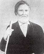 |
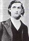 |
Captain William Turner Sadler |
Garrison Greenwood |
Captain Sadler's company of ten Rangers, all residents of present Houston and Anderson counties, were enrolled for a three month tour of duty beginning January 1st, 1836. In March, the men were assigned the task of constructing a blockhouse that would become known as Fort Houston. By the time the Rangers began the job, several cabins had already been partially completed there by the local settlers and they welcomed the protection. Regional Ranger Superintendent Garrison Greenwood described the situation to Sam Houston in a letter dated March 7th:
This place and the adjoining frontier is exposed from the Indians who inhabit in great numbers this part of the country-the Ionis, the Caddos, Anadarkos, the Kickapoos, the Ayish, and the Kichais and Tawakonis are supposed to be not far north and frequently through the country. These all range the woods and now and then steal horses, and with them there has that I know of been as yet no settled principal of action nor of friendship established-which leaves us without any grounds of confidence to expect anything more of them than has ever been the practice of the savage when the times and circumstances afforded a favorable opportunity of venting their malignant spleen.
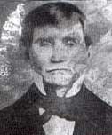
Major James Smith
In September, 1836, Major James Smith was ordered to recruit four companies to replace Greenwood's Ranger battalion. They finished construction on Fort Houston as well as reinforcing Clapp's Blockhouse, Brown's Fort, Lacy's Fort and Parker's Fort.
Fort Houston
Marker Title: Fort Houston
City: Palestine
County: Anderson
Year Marker Erected: 1969
Marker Location: Intersection of US 79 and FM 1990, 2 mi. south of Palestine, .25 mi. north of Ft. Houston on FM 1990 just past tracks.
Marker Text: (site one-fourth mile south) A stockade and blockhouse of the Republic of Texas. Built in 1835-1836 to protect settlers who founded Houston, a pioneer town, now in Anderson County. Friendly Indians would come to trade at the site, but wary settlers often slept inside the 25-foot-square blockhouse, built of heavy logs. Trappers bought supplies there and men from Houston formed one of the first Ranger units in Texas. The fort defended a large area of the frontier, 1836-1839, but it was abandoned about 1841. The site later became part of home of John H. Reagan, Texas Statesman.
More on Fort Houston
Fort Houston Cemetery
Marker Title: Fort Houston Cemetery
Address: Harcrow Road, west of Loop 256
City: Palestine
County: Anderson
Year Marker Erected: 1985
Marker Location: Harcrow Road, west of Loop 256, Palestine
Marker Text: In 1835, Joseph Jordan and William S. McDonald donated about 500 acres of land in this area for the town of Houston, later known as Fort Houston. An early map of the townsite shows a section designated as a "public burying ground." The infant child of the Rev. Peter Fullinwider, an early Protestant minister in Anderson County, is said to have been the first to be interred here. The oldest marked grave, that of Dr. James Hunter, is dated 1840. The Fort Houston Cemetery is the only remaining physical evidence of the early frontier town, which was abandoned after Palestine was made Anderson County seat in 1846. Victims of diseases, Indian massacres, and other hardships that faced early Texas settlers are buried here. A special soldiers' plot, marked with a large boulder, contains the graves of soldiers of the Republic of Texas. Two veterans of the Battle of San Jacinto, John W. Carpenter and James Wilson, are buried in unmarked graves. The burial site of General Nathaniel Smith, a War of 1812 veteran, is also located in the soldiers' plot. The Fort Houston Cemetery remains in use as a public burial ground and as a reminder of the early history of the area. (1985)
Vicinity of Fort Inglish
Marker Title: Vicinity of Fort Inglish
City: Bonham
County: Fannin
Year Marker Erected: 1972
Marker Location: near corner of Lipscomb and 9th St.
Marker Text: (exact original location unknown) Spot where settlement of town of Bonham began. On 1,250-acre land grant of Texas Republic to Bailey Inglish (1797-1867), former Miller County, Ark., sheriff who led train of settlers traveling by oxcart to this site in 1837. Here they built a log stockade and blockhouse with gun ports for use in community defense. In a typical fight (1841), the Indians were repulsed, but captured two young boys hunting cows near the fort. (The boys returned later.) Called Bois d'Arc in 1840, town was renamed (1843) to honor Texas War for Independence hero, Col. James Butler Bonham (1807-1836).
Thanks to Dori Leatherwood from the Bonham Chamber for providing the following article on Fort Inglish.
Fort Inglish. During the early years of the Republic of Texas Fannin County residents lived in constant danger of Indian attack, and Fort Inglish was a frequent refuge for settlers on the western edge of the Red River frontier.
It was built in the summer of 1837 by Bailey Inglish in the form of a single blockhouse, sixteen feet square and topped by an overhanging story twenty-four feet square, probably surrounded by a log stockade. Fort Inglish was on grounds now occupied by a Veterans Administration center, north of
East Ninth Street and east of Lynn street, in downtown Bonham. Although it was private, Fort Inglish played a role in several official campaigns against the Indians by the Army of the Republic of Texas. In November 1838 it served as the rendezvous point for the militia brigade of Gen. John H.
Dyer during the Rusk-Dyer Indian expedition, and in October 1840 Col. William G. Cooke's troops straggled into Fort Inglish after the near-disaster of the Military Road expedition. After the removal of the Indian threat to white settlement in Northeast Texas in the early 1840s, however, Fort Inglish fell into disrepair and was eventually dismantled. More
Fort Milam
Marker Title: Fort Milam
City: Marlin
County: Falls
Year Marker Erected: 1936
Marker Location: From Marlin, take FM 712 about 4 mi SW to FM 2027, then go south 2 mi. to local road. Take road east .7 mi. to Brazos River Falls.
Marker Text: Built at the capital of Robertson's Colony named in 1834 Sarahville De Viesca in honor of his mother Sarah Robertson and the Governor of Texas, Agustin DeViesca. Soon after its name was changed to Milam, December 27, 1835, a ranging company built the fort as a protection to the settlers against hostile Indians. More
Fort Parker
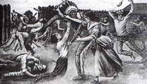
Parker's Fort Massacre drawing published
in
1912 in DeShields' Border Wars of Texas.
Marker Title: Fort Parker
Address: Of FM 1245, in Fort Parker Historical Park
City: Groesbeck
County: Limestone
Year Marker Erected: 1965
Marker Location: Fort Parker Historical Park, off SH 1245 on park rd. 35, N of Groesbeck.
Marker Text: Built 1834 for protection from Indians. Named for leaders who bought first Predestinarian Baptist church body to Texas: Elder Daniel Parker; his father, Elder John; bothers Jas. W., Benjamin, Silas, John. Also here were Kellogg, Frost, Nixon, Duty and families on May 18, 1836, raiding Comanches killed Benjamin, John and Silas Parker, Samuel and Robert Frost and others; captured Elizabeth Kellogg, Rachel Plummer and son James, and Sila's children, John and Cynthia Ann in captivity, Cynthia Ann married Chief Peta Nacona; her son, Quanah, was last Comanche Chief. With her baby, Prairie Flower, in 1860 she was captured by Texas Rangers. She, the baby and Quanah are buried at Fort Sill.
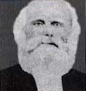
Luther Thomas Martin Plummer
His pregnant wife and son were both taken
hostage by the Comanches from Parker's Fort.
Fort Parker Memorial Park
Marker Title: Fort Parker Memorial Park
Address: Off FM 1245, in Fort Parker Historical Park.
City: Groesbeck
County: Limestone
Year Marker Erected: 1964
Marker Location: Off FM 1245, on Park Rd. 35, Fort Parker Historical Park, N of Groesbeck
Marker Text:--
Old Fort Parker State Historic Site
Museum Name: Old Fort Parker State Historic Site
Mailing Address: Rt. 3 Box 746
Street Address: State Park Rd. 35
City: Groesbeck
Zip Code: 76642
Area Code: 254
Phone: 729-5253
County: Limestone
More on Parker's Fort
Fort St. Louis
Marker Title: Fort St. Louis
Address: SW corner of FM 444 & US 59
City: Inez
County: Victoria
Year Marker Erected: 1936
Marker Location: SW Corner of intersection of FM 444 & US 59, Inez.
Marker Text: Thirteen miles southeast of Inez is located the site of Fort St. Louis. First French settlement in Texas attempted by Rene Robert Cavelier Sieur de La Salle in 1685. Devastated by the Karankawa Indians, burned by members of the Alonso De Leon Expedition in 1689. On its remains the Spaniards constructed Presidio de Nuestra Senora de la Bahia del Espirtu Santo, Marquis of Aguayo and Father Fray Agustin Patron, O.F. M. In 1722 as a protection for the mission of Nuestra Senora del Espiritu Santo de Zuniga for the civilizing and christianizing of the Indian tribes of the vicintiy moved to Mission Valley on the Guadalupe River near the present Victoria in 1726; moved finally to Santa Dorotea in Goliad near the San Antonio River in 1749. More
Galveston
Marker Title: Galveston Island
Address: SH 87 at Galveston Ferry Landing
City: Galveston
County: Galveston
Year Marker Erected: 1962
Marker Text: Few spots have played a more exciting role in the life of Texas than Galveston Island. Cabeza de Vaca, the Spanish explorer, wrote of the cannibalistic Karankawa Indians when he was shipwrecked here in 1528. The island became headquarters for Jean Lafitte and other adventurers between 1815 and 1821. Importance of the harbor was recognized as early as 1825 when Stephen F. Austin petitioned the Mexican government to establish a port. Galveston became temporary capital of the Republic in April, 1836, when President David G. Burnet fled here at the approach of Mexican Gen. Santa Anna. After the revolution Galveston's place as first city of the Republic became fixed. Immigrants poured through the port. The Texas Navy was berthed here. With statehood in 1845 came continued growth; Texas first telegraph (1854), first national bank (1865), first electric lights (1888). Capture and recapture of Galveston were principal Texas engagements of the Civil War. The port fell to blockading Union troops Oct. 4, 1862. It was retaken Jan. 1, 1863, by Gen. John B. Magruder and remained in Confederate hands. Galveston was again on the nation's lips Sept. 8, 1900, when a hurricane packing winds of 120 mph swept a vast tidal wave across the island, killing 5,000. No other American disaster has taken a greater toll. The storm had two immediate results -- construction of a protective seawall 17 feet high and 7-1/2 miles long and creation of a commission form of city government, an innovation that spread to other American municipalities. The port remains one of the state's most important, handling more sulphur than any in the world. Important to sightseers and motorists are the toll-free ferries operated by the Texas Highway Department across the 2-1/2-mile strait between the island and Port Bolivar. More
Goliad
Marker Title: Goliad
City: Goliad
County: Goliad
Year Marker Erected: 1965
Marker Location: Fannin Plaza, corner of Market Street and Franklin Street.
Marker Text: One of the three first Texas municipalities. Old Aranama Indian village called Santa Dorotea by the Spanish. Presidio La Bahia and Mission Espiritu de Zuniga established 1749. Here early events leading to the Texas Revolution were expeditions of Magee-Gutierrez, 1812; Henry Perry, 1817; James Long, 1821 Name changed Feb. 4, 1829, from La Bahia (the Bay) to Goliad. Honoring (in anagram) Mexican patriot (H)idalgo. Capt. George Collingsworth, Ben Milam and 48 men took Mexican garrison Oct. 8, 1835. Goliad Declaration of Independence signed Dec. 20, 1835, and Goliad flag unfurled. Defender Capt. Philip Dimmit succeeded by Col. James Walker Fannin, Feb. 7, 1836. On order of Gen. Sam Houston to evacuate Goliad, Fannin on Mar. 19, moved toward Victoria. Overtaken 9 miles out by a large Mexican army, Fannin and his men battled until night, surrendered next morning. From La Bahia Prison they were marched out, massacred and partially cremated on Palm Sunday, Mar. 27, 1836. After Texas won independence, Gen. Thomas Rusk's army gave them military rites and burial, June 1836. Goliad County Seat since 1836. Incorporated 1840 and built on present site. Received 4 leagues of land in grant signed by President Sam Houston, 1844. (1965) More
Harrisburg
Marker Title: Old Harrisburg
Address: 8100 block of Lawndale at Frio
City: Houston
County: Harris
Year Marker Erected: 1965
Marker Location: Frost Bank
Marker Text: Early Texas port and trading post. Site of state's first steam saw, grist mills and railroad terminal. Town founded, 1826, by John R. Harris, who was first settler in 1823. Became shipping center for early colonies, established when Texas was part of Mexico, with boats carrying cargo to and from Texas ports and points in the United States and Mexico. Became the seat of government of the Republic of Texas, March 22 - April 13, 1836, when David G. Burnet, President of the ad interim government and several of his cabinet resided near here in the home of Mrs. Jane Harris (site marked), widow of town founder. Here President Burnet adopted the flag for the Texas Navy. In 1835, local resident, Mrs. Sarah Dodson, had made here the first tri-color lone star flag. General Santa Anna attacked the town with 750 Mexican soldiers on April 16 attempting to capture Burnet and his cabinet. The whole town was burned. After Texas gained its independence at nearby San Jacinto, the town was rebuilt and again thrived. The Buffalo, Bayou, Brazos and Colorado, first railroad in Texas began here in 1852 and by the Civil War made the town a Confederate rail center. Became a part of Houston, by annexation, in 1926.
Harvey Massacre
Marker Title: Harvey Massacre
City: Calvert
County: Robertson
Marker Location: 5 mi. north of Valvert via Hwy. 6.
Houston City
Marker Title: Houston City, Republic of Texas
Address: Sam Houston Heritage Park
City: Houston
County: Harris
Year Marker Erected: 1965
Marker Location: 400 block McKinney
Marker Text: By vote of Congress, Nov. 30, 1836, chosen temporary capital for new Republic of Texas. At the time a small townsite at the head of Buffalo Bayou navigation. Into a "Houston City" of mud, tents, cabins on April 1, 1837, came President Sam Houston and his government. Finding its quarters unfinished, Congress postponed its opening session until May 1. The capitol building was a 2-story plantation style house, with columned porches. It was scene of many important Indian treaties, diplomatic negotiations, legislative functions. As no church yet graced the city, it also was used for religious services. That muddy April saw the city hold its first big social event-- the anniversary celebration of the San Jacinto victory, with parade, reception and ball. On Dec. 5, 1837, some war heroes and other leaders founded in the capital the Texas Philosophical Society, the Republic's first learned organization. In a powdered wig, and dressed to resemble George Washington, President Houston made a 3-hour farewell address, after which Mirabeau Buonaparte Lamar was inaugurated his successor on Dec. 10, 1838. In 1839, removed to Austin, the capital returned here, but only briefly, 1842, in Mexican invasion.
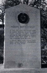
Indian Battlefield Centennial Marker
Photo from the book, Savage Frontier II, by Stephen L. Moore
Indian Battlefield
Marker Title: Indian Battlefield
City: Marlin
County: Falls
Year Marker Erected: 1963
Marker Location: From Marlin, Take SH 6 north about 6.5 mi.
Marker Text: At this site, near the pioneer home of George Morgan,
a battle took place, January 16, 1839, between settlers in this region
and Indians under Chief Jose Maria in which the colonists were defeated.
A treaty with these Indians made soon after brought comparative peace
to this region. More
Battle of Jones Creek
Marker Title: Battle of Jones Creek
City: Jones Creek
County: Brazoria
Year Marker Erected: 1965
Marker Location: SH 36 at Peach Point Rd.
Marker Text: Fought by Texan army of 23 men under Capt. Randal Jones (1786-1873), sent out 1824 by Stephen F. Austin to the lower Brazos to fight cannibal Karankawa Indians. Scouts found the camp here. Attack at dawn found Indians ready with spears. Jones' guns got 15 Indians, dispersed the rest. (1965)
Jonesboro
Marker Title:
Jonesboro
City:
Jonesboro
County:
Red River
Year Marker Erected:
1973
Marker Location:
Sam Houston Park on FM 410, about 25 mi. NW of Clarksville.
Marker Text:
(19th century town) One of first ports of entry into Texas for Anglo-Americans. Opened early as 1814; heavily used by 1817. Named for 1819-21 ferry owner Henry Jones (1789-1861). Claimed by both Mexico and the United States, town was 1828-37 county seat of Miller County, Ark. Community had 2,350 people by 1834. At this crossing Sam Houston (1832) and David Crockett (1835) entered Texas. A well-known road led southeastward to other colonies by way of Nacogdoches. In 1836, Clarksville became Red River District's capital. By 1840 Jonesboro had lots its trade and many settlers to other areas.
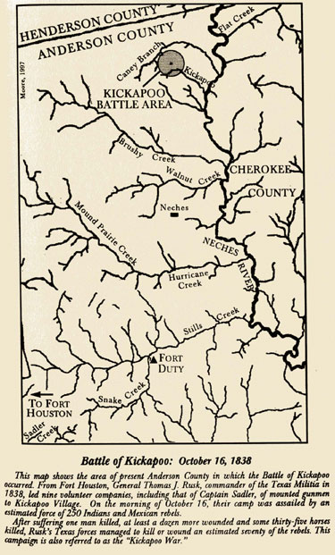
Map from the book, Taming Texas, by Stephen L. Moore
Site of the Kickapoo Battlefield
Marker Title: Site of the Kickapoo Battlefield
City: Frankston
County: Anderson
Year Marker Erected: 1936
Marker Location: about 2 mi. SE of Frankston on FM 19 - just
before CR.
Marker Text: Here General Thomas J. Rusk with 200 Texans on October
16, 1838, attacked a band of hostile Indians and allied Mexicans, molesters
of frontier settlements, and routed them. More
Killough Massacre
Marker Title: Killough Massacre
City: Jacksonville
County: Cherokee
Year Marker Erected: 1965
Marker Location: 7 miles northwest of Jacksonville on US 69, north to
FM 855 then southeast on CR 3405 to monument site on CR 3411
Marker Text: In this area, on October 5, 1838, the Killough, Wood and
Williams families were attacked by hostile Indians and Mexicans: 18 were
either killed of carried away; 8 escaped on horseback; 3 women with a
baby fled on foot and were saved on third day by a friendly Indian. Was
biggest Indian depredation of East Texas. Bodies of the victims found
were buried here.
General Rusk ordered East Texas captains to raise new Ranger companies. The worst massacre suffered in the new settlements occurred on the heels of the order spurring the troops to action. More
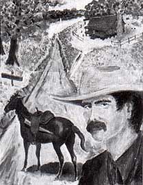
Elisha Clapp
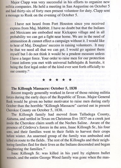
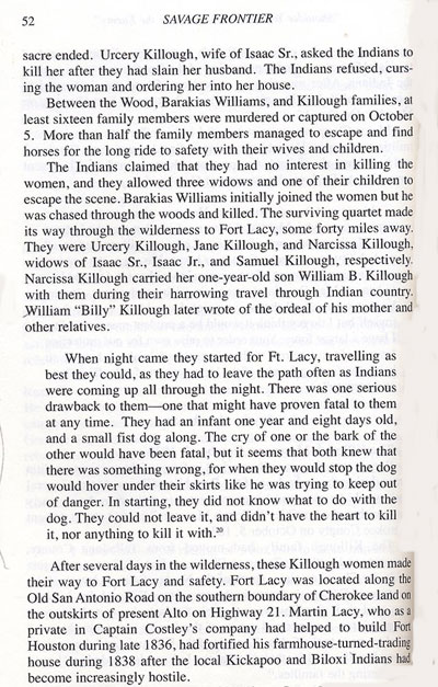
Savage Frontier II
Elias Vansickle escaped Cordova's rebels and reported in January, 1839, that Mexican troops and East Texas Indians planned immediate attacks on the white settlements and further confirmed a suspected Cherokee had participated in the massacre.
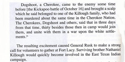
Savage Frontier II
King's Fort
Marker Title: King's Fort
Address: 607 N. Clay St.
City: Kaufman
County: Kaufman
Year Marker Erected: 1997
Marker Text: An early frontier fort of the Republic of Texas, King's Fort was built in June of 1840 by a survey party led by Warren A. Ferris, then Nacogdoches County surveyor. Dr. William P. King of Mississippi financed the expedition and accompanied Ferris. Because the fort was located on a favorite hunting ground for area Indians, settlement was delayed several years by fear of attacks. The fort, with its four cabins and a stockade, was used primarily as a way station and place of refuge for travelers. William King continued his efforts to lure settlers to the area, buying area land until shortly before his death in 1841. When Charles F. Mercer's colonists began to arrive in the vicinity between 1844 and 1846, King's Fort became the center of a dispersed community known as Kingsborough. Kaufman County was formed in 1848. The town lost its bid to be the county seat then and in 1850, but won a crucial election in 1851. The name of Kingsborough was changed to Kaufman according to state law. Though her legal claim to the title was disputed, King's widow, Frances Tabor, is credited with the donation of 150 acres of the Kingsborough tract to the county seat for a townsite. (1997)
Site of Lacy's Fort
Marker Title: Site of Lacy's Fort
City: Alto
County: Cherokee
Year Marker Erected: 1936
Marker Location: about 2.5 miles West of Alto on SH 21
Marker Text: Built before 1835 as a home and trading post by Martin Lacy,
Indian agent for the Mexican government. Used as a place of refuge after
the massacre of the Killough family, October 5, 1838.
Liberty City
Marker Title: Liberty City
City: Kilgore
County: Gregg
Year Marker Erected: 1965
Marker Location: 1 mi. north of I-20 on old 135-Gladewater Hwy., 4 mi. north of Kilgore
Marker Text: Historic rural community in oil-rich Gregg County. Settled before Civil War. Has also been known as Sabine, Mount Moriah, McCrary's Chapel, Goforth and Hog Eye (for an early settler with an "eye" for hogs). Present name adopted in early days of famous East Texas oil boom. Area served by Sabine School district, established 1893; an example of excellent schools in county. Also crossed by great system of improved, all weather county roads-- finest in state. Center of farming, livestock raising. Has fine churches, park and community meeting places.
Little River Fort
Marker Title: Little River Fort
City: Belton vicinity
County: Bell
Year Marker Erected: 1969
Marker Location: 2 miles north of Belton on IH-35 to roadside park at Lampasas River bridge.
Marker Text: A stockade and blockhouse of the Republic of Texas. Built in November, 1836, by a unit of some 20 Rangers under Lt. George B. Erath (soldier-statesman for whom Erath County was named). By Christmas they had erected 7 or 8 cabins, a blockhouse and a picket stockade, which enclosed about 1/2 acre of land. A spring nearby supplied water. Rations included an ear of corn daily, game, honey and a little coffee. The Rangers withdrew about May, 1837. Later the fort was used by settlers, hunters and adventurers. The remains of the structures were removed, 1840's. (1969)
Little River Settlers Attack
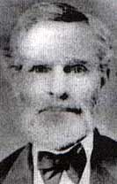
Orville Thomas Tyler (1810-1886) was among the
Childers party that was attacked by Indians on June 4, 1836.
Photo from DeShield's book, Border Wars of Texas.
June 4th, 1836, Cameron Texas, seventeen settlers under Captain Goldsby Childers were retreating to Nashville for protection from the warring Indians. Montgomery Shackleford describes the account:
"When they approached within two hundred yards, they divided, one half to the right, the other half to the left-passed us shooting at us-and pursued and killed Crouch and Davidson, who were some three hundred yards ahead of us. Before they could gain, those of us who were near the wagon made our way to some timber that was near. The Indians drove off our cattle and took one horse; the balance of the company escaped without further injury."
The Indians scalped Crouch and Davidson after killing them and began to fight over who would keep the scalps and booty. Childers took this opportunity to lead his party to safety under the cover of some oak trees. The Indians turned back and headed for the Little River houses where they found the remaining families. Daniel Monroe relates:
"They used guns, bows and arrows, and spears. Whilst defending themselves in their house against the Indians, William Smith was shot on the outside of the door through the leg by a rifle ball. They shot and killed deponent's horse whilst tied to the house-killed many cattle-drove the balance off-and plundered a wagon."
A few days later, Judge O.T. Tyler performed last rites at the gravesite on the prairie where the killings took place.
Matagorda
Marker Title: City of Matagorda
County: Matagorda
Year Marker Erected: 1936
Marker Location: southeast corner of Cypress and Lewis; Matagorda
Marker Text: Projected site of a town in 1826. Founded in 1829 with Stephen F. Austin, Elias R. Wightman, Hosea H. League and Ira Ingram as proprietors. Third largest town in Texas in 1834. Incorporated January 28, 1839, county seat of Matagorda County, 1837-1894. Badly wrecked by storms in 1854 and 1875. An early cultural center of Texas as evidenced by schools, churches and press.
Mier Expedition
Marker Title: The Mier Expedition
Address: US 83 about 1 mile west of Roma
City: Roma
County: Starr
Year Marker Erected: 1936
Marker Location: From Roma, take US 83 about 1 mile west.
Marker Text: A body of Texans intent on invading Mexico camped here on December 21, 1842. After being made prisoners at Salado, Mexico, they drew beans, white for life in prison, black for death. 17 members of the expedition were shot by order of General Santa Anna, March 25, 1843.
Battle of Nacogdoches
Marker Title: Battle of Nacogdoches
City: Nacogdoches
County: Nacogdoches
Year Marker Erected: 1979
Marker Location: corner of Fredonia and El Camino Real
Marker Text: (August 2, 1832) One of the opening actions of the Texas
War for Independence, this battle occurred soon after settlers drove out
the Mexican garrisons at Anahuac and Velasco. In 1832 Col. Jose de las
Piedras, in command of over 300 soldiers here, ordered the residents to
surrender all firearms. Citizens of Nacogdoches and other East Texas towns
resisted by forming the "National Militia," commanded by James
W. Bullock. When Piedras refused to support the constitution of 1824,
the militia marched toward the Mexicans on the square and the Mexicans
opened fire. In hand-to-hand combat, the militia took the stone fort and
several nearby structures, but the Mexicans continued to hold Piedras'
headquarters in the red house. Adolphus Sterne showed San Augustine "redlanders"
how to outflank the Mexicans. Piedras' men fled during the night and were
captured August 3 by militiamen near Loco Creek. Fighting ended after
the Mexicans arrested their leader at John Durst's home. A peace treaty
was signed on August 6. Piedras lost 47 men. Four Texans died, including
the alcalde of Nacogdoches, Encarnacion Chireno. Because of this incident,
Mexican troops were never again stationed in East Texas, leaving settlers
free to meet and air their grievances.
Battle of the Neches
Marker Title: Battle of the Neches
City: Colfax
County: Van Zandt
Year Marker Erected: 1968
Marker Location: Roadside park on Hwy. 20, 5 mi E of Colfax
Marker Text: (Site 15 miles southeast) Main engagement of Cherokee War;
fought July 15 and 16, 1839, between 800 Indians (Including; Delawares
and Shawnees) and 500 troops of the Republic of Texas. An extraordinary
fact is that David G. Burnet vice president of the Republic; Albert Sidney
Johnston, secretary of war; and two other high officials took active parts
in the fighting. When killed, Chief Bowles, aged Cherokee leader, carried
a sword given him by Gen. Sam Houston. After the defeat of the tribes,
they scattered, thus virtually ending Indian troubles in the settled eastern
part of Texas. (1968)
More
Battle of Palo Alto
Marker Title: Battle of Palo Alto
County: Cameron
Year Marker Erected: 1936
Marker Location: From Brownsville, take FM 1847 north about 5.5 miles to intersection of FM 1847 and FM 511.
Marker Text: Was fought here May 8, 1846 and was won by the Army of the United States.
Post Oak Springs Massacre
May 6, 1837, a band of Indians entered the Brazos settlements killing a man named Neal, right on the edge of Nashville and then headed northwest toward the Little River Fort where they encountered and killed a five man Ranger party near Post Oak Springs.
Battle of Resaca de la Palma
Marker Title: Battle of Resaca de la Palma
County: Cameron
Year Marker Erected: 1936
Marker Location: Paredes Line Road, .2 mile north of Price Road, Brownsville.
Marker Text: Was fought here May 9, 1846; And the defeat of the Mexican Army under General Mariano Arista by the United States troops under General Zachary Taylor made good the claim of Texas to the territory between the Nueces and the Rio Grande.
City of Richmond
Marker Title: City of Richmond
Address: Houston & 5th St.
City: Richmond
County: Fort Bend
Year Marker Erected: 1969
Marker Text: Area was settled in 1822 by members of Stephen F. Austin's colony, who first called their community "Fort Settlement." Earliest known burial was made by Wm. Morton, who donated land for Morton Cemetery. Town was formally laid out 1837 by land promoters R. E. Handy and Wm. Lusk, who named it for Richmond, Virginia. City was elected county seat in 1838. Most famous resident was Mrs. Jane Long, "Mother of Texas," who ran Veranda Hotel and established a plantation here in 1837. She is buried in Morton Cemetery. Also in 1837 famous scout Erastus "Deaf" Smith died here and was buried in the city. County purchased first courthouse in 1842; built a brick on in 1849. In 1855 an extension of the Buffalo Bayou, Brazos & Colorado Railroad (the first railroad in Texas) brought increased prosperity. Vigorous saloon fighter Carry Nation operated the National Hotel here prior to moving to Kansas. Her departure was connected with the "Jaybird-Woodpecker" political feud, which climaxed in a shootout around the Courthouse Square in 1889. Another noted Richmond citizen, John M. Moore, led way in raising quality of range cattle. Service in Legislature, 1896-1905, and U. S. Congress, 1905-1913.
Riley Massacre
January 1836, Thomas and James Riley were attacked by a band of forty Caddos and Comanches. Thomas was killed and his brother was severely wounded but survived. Stephen L. Moore describes in his book, Savage Frontier, how the Riley depredation caused the formation of Sterling Clack Robinson's Ranger company in January, 1836.
This event happened along the upper tributaries of the Little River, a hunting grounds the Indians called "Teha Lanna" or "the Land of Beauty." The pioneers they attacked were brothers James and Thomas Riley, who were traveling with two loaded wagons and their wives, children, and another young man.
Near the mouth of Brushy Creek on the San Gabriel River, the Rileys met surveyor William Crain Sparks and his servant Jack. These three were returning from Sparks' camp near the Little River, where they had encountered Indians. Sparks and Jack Had set out from Tenoxtitlan with a man named Michael Reed and an ox wagon loaded with corn. As dusk fell on their camp on the Little River, Reed crossed the river to visit the camp of newly arrived emigrant John Welsh. During his absence, Indians attacked the camp of Sparks and Jack, who both hid in a thicket.
Sparks and Jack survived then set out after morning for Tenoxtitlan. En route, near where Brushy Creek met the San Gabriel, these two happened upon the Rileys. They advised the Rileys to turn back, but their warning was not heeded. Within another mile the Rileys encountered a band of about forty Caddos and Comanches. The Indians claimed to be friendly and stated that they were only following Sparks and his black man.
The Riley party decided to turn back at this point, but the Indians attacked them just as they reached the Brushy Creek bottom. One of the Indians leaped onto the lead wagon horse and cut loose the harness. Before he could strike, one of the Riley men shot him dead and thus started the general fight. Thomas Riley managed to kill two Indians before being mortally wounded himself. James Riley also killed two of his attackers but was severely wounded in four places before the remaining Indians fled.
The younger man accompanying the Rileys fled with the women and children during the engagement. They reached the settlements on the Brazos safely within two days. The seriously wounded James Riley laid his brother Thomas's body on a mattress and wrapped it before mounting a horse and heading for Yellow Prairie in present Burleson County. After reaching safety the next day, he returned with a party to bury his brother.
Riley survived with severe wounds that kept him confined for a long period of time. A petition was presented to the Congress of Texas in 1840 for the republic to provide aid to the crippled James Riley in supporting his wife and six children.
Empresario Sterling Clack Robertson organized a ranger company to defend the citizens of his colony. The unit's muster roll shows that they were mustered into service on January 17, 1836. The Riley death was reported in the January 23 issue of the Telegraph and Texas Register, noting that the Indians had taken eight of the Riley's horses. The paper reported that a company of twenty-five men had gone immediately in pursuit of the Indians. This number obviously increased as more men joined Robertson's company, for his muster roll, signed by Robertson as "Captain Rangers," shows a total of sixty-five men.
Among the members of the company was Elijah Sterling Clack Robertson, the fifteen-year old son of the captain. The company also included rangers who had recently served under Captains Daniel Friar and Eli Seale. Friar's reduced company remained in service throughout January, although at least eight of his men had enlisted in Robertson's new company.
Robertson's company had returned back to town by January 26, on which date empresario Robertson was conducting colony business. It is unknown exactly how long Robertson's ranger company remained in service, but it was disbanded by late February. Sterling Robertson was elected to the Convention of March 1 on February 1. Correspondence of Captain Robertson further places him at Milam as of February 7 and at the Falls of the Brazos as of February 18.
Battle on the Rio Blanco
Castleman gathered his family and hurried to Gonzales where volunteers were raised for pursuit. Just outside of San Marcos on bluff of Blanco River, April 18th, 1835, Captain Bartlett D. McClure's posse of about thirty men found the murderers. The posse split into two parties, one circling around while the other attacked. John Castleman was among those who killed a few warriors during the advance. Andrew Sowell Sr. was part of the group of volunteers waiting behind the Indians in ambush. His nephew, A. J. Sowell, later wrote:
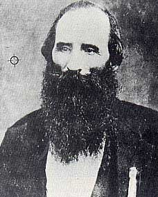
Asa J.L. Sowell
Several shots were fired, and a third Indian had his bow stick shot in two while in the act of discharging an arrow. Andrew Sowell attempted to fire with a flintlock rifle, but it flashed in the pan. He had stopped up the touch-hole to keep the powder dry in the fog, and had forgotten to take it out. The other Indians now ran back towards the river, yelling loudly. By this time most of the men had gotten clear of the brush and charged with McClure across the open ground.
...Captain McClure's volunteer forces pursued the Indians to the Blanco River, where the fighting became more general. More of the fifty-odd Comanches were killed as they tried to cross the water with their stolen goods. Andrew Sowell shot and killed on Indian as he tried in vain to climb a steep bank on the far side. In the end, they left much of their spoils behind and moved swiftly from the area. The whites chose not to cross the river and continue their pursuit. They were fortunate to have not had any man killed or any serious injuries sustained.
Ripley Massacre
Marker Title: Ripley Massacre
City: Mt. Vernon
County: Franklin
Year Marker Erected: 1986
Marker Location: US 67 at Ripley Creek Crossing, 4 mi. east of Mt. Vernon
Marker Text: Ambrose Ripley and his wife Rachel (Wood) brought their family to Texas in 1837, settling near here in what was then Red River County. They established their home near the Nacogdoches Road (Cherokee Trace) and a stream now known as Ripley Creek. On April 10, 1841, while Ripley was away, a band of Indians attacked his farmstead, killing first his eldest son who was plowing in the field. Mrs. Ripley and five children were killed trying to reach a canebreak and one infant died when the house was burned. Two of Ripley's daughters eluded the Indians and made it to a neighboring farm. Charles Black and Charles S. Stewart led a group of settlers north in pursuit of the band. Near the Sulphur River, they encountered Indians, who may or may not have been involved in the massacre, and attacked them, killing several. The Ripley family massacre was an isolated incident in this area, but it proved to be a rallying point for increased frontier defenses and for support of the anti-Indian policies of Texas President Mirabeau B. Lamar. The attack also influenced the formation of a militia unit under the leadership of Gen. Edward H. Tarrant and Cols. James Bourland and William C. Young to rid the area of Indians. Texas Sesquicentennial 1836 - 1986
Battle of the Salado
Marker Title: Battle of the Salado
City: San Antonio
County: Bexar
Year Marker Erected: 1936
Marker Location: 1006 Holbrook, San Antonio
Marker Text: The Battle of the Salado, decisive in Texas history,
was fought here September 18, 1842. Col. Mathew Caldwell and Capt.
John C. Hays, commanding a force of Texas volunteers, opposed the
Mexican Army under General Adrian Woll that had captured San Antonio,
and with the loss of only one man, checked the last Mexican invasion
of Texas and thereby prevented the capture of Austin, capital of the
Republic of Texas. (1936)
San Felipe de Austin
Marker Title: San Felipe de Austin
City: San Felipe
County: Austin
Year Marker Erected: 1964
Marker Location: FM 1458 right-of-way, San Felipe
Marker Text: First Anglo-American capital of Texas. Came into being on July 26, 1828, as capital of the Austin Colony, by decree of the Mexican government. Father of Texas Stephen F. Austin had begun under the 1821 grant from Mexico the settlement of more than 1,000 families. The original colony ran from the coast on the south to the old San Antonio Road on the north, and from the Lavaca River on the west to the San Jacinto River on the east. In this first American town in Texas lived Austin, William Barret Travis, Sam Houston, David G. Burnet and Jane Long. All settlers crossed its threshold for land grants. After the organization of other colonies, this continued to be the recognized center of Texas. It was capital of the Mexican Department of Brazos, site of the Conventions of 1832 and 1833 and the Consultation of 1835 where Texans aired grievances and tried to reach understanding with Mexico. The provisional government created with Henry Smith as governor in 1835 functioned here until it gave way to the convention declaring Texas independent of Mexico on March 2, 1836. (1964)
Depredation on the San Gabriel
During late September, surveyor Thomas A. Graves set out from Bastrop in Robertson's Colony with a party of seventeen land surveyors and speculators. After surveying ten leagues near the San Gabriel River, one of the small groups of surveyors was attacked by a party of Indians. An Irishman named Lang was killed and scalped while working his compass. One of the men of the party of four escaped and ran to the men under Graves to spread the news. The other two men being unaccounted for, the men under Graves decided to go in search of them.
One of Graves' surveyors was George Erath, who had joined his surveying party after serving in the Moore expedition through August 28. Erath felt that "there was little danger in our whole party remaining a few days longer," as the Indians were believed to have fled after lifting their scalps. Graves' men went to the scene of the attack but didn't find any bodies. The Indian attack was enough to cut short this surveying trip, as Erath recalled:
We paused there and, after another deliberation, Graves cut the matter short by declaring he had fitted out the expedition, would have to pay the hands, and did not propose to be at unnecessary expense in public service. So we turned back. Had we gone but a few hundred yards farther we would have found Lang's body.
Before returning to Bastrop, Graves' surveying party did find two other badly frightened survivors of this Indian depredation.
Graves, Erath, and the other surveyors returned from their expedition early in October and made town at Hornsby's settlement. There, they found events that would forever change the future of Texas had occurred in their absence.
Battle of San Jacinto
Marker Title: Battle of San Jacinto
City: Houston
County: Harris
Year Marker Erected: 1964
Marker Location: take the LaPorte Fwy. (SH 225) east to Battleground Rd. Exit (SH 134), go north; marker is on west side of road.
Marker Text: At mid-afternoon April 21, 1836, two miles to the north, General Sam Houston with about 1,000 Texans in 18 minutes annihilated the 1,400-man army of Antonio Lopez de Santa Anna, President of Mexico. Screened by trees and rising ground, Houston's men formed with Edward Burleson's regiment at center, Sidney Sherman's on the left wing, artillery under George W. Hockley on Burleson's right, the infantry under Henry Millard on the right of the artillery. Under M. B. Lamar, a future president of Texas, the cavalry took the extreme right, to cut off possible flight of Mexican troops. Their 4-piece band playing a popular love song, "Will You Come to the Bower," the Texans attacked at a run, crying, "Remember the Alamo! Remember Goliad! "Such was their fury that 630 of the enemy were killed, 730 captured. enemy lead shattered Gen. Houston's ankle, but he lost only 9 men killed or mortally wounded and 30 wounded less seriously. San Jacinto stands as one of the world's greatest victories It gave Texas independence, and with her annexation 9 years later brought into the Union all or parts of Arizona, California, Colorado, Kansas, New Mexico, Nevada, Oklahoma, Utah and Wyoming.
Stringfield Massacre
Marker Title: Stringfield Massacre
County: McMullen
Year Marker Erected: 1968
Marker Location: From Tilden, take Highway 16 about 23 miles to Route 624, go west about 2.5 miles to rest stop.
Marker Text: On Sept. 28, 1870, the Thomas W. Stringfield family was ambushed by Indians and bandits raiding from Mexico. Overtaken in their horse-drawn wagon, the victims ran for a nearby house, but did not reach it. Thomas and wife Sarah Jane were stabbed and shot to death. Six-year-old son Adolphus was also murdered, but the fate of Thomas, 4 years, was never known. The survivor, 8-year-old Ida Alice, fought to avoid capture. She was then speared 7 times, trampled by the raiders' horses, and left for dead. She was later rescued and lived until 1937.
Vicinity of Texas Rangers' Battle of May 29, 1850
Marker Title: Vicinity of Texas Rangers' Battle of May 29, 1850
City: Alice
County: Jim Wells
Year Marker Erected: 1969
Marker Location: from Alice, take Highway 281 north about 14.4 miles.
Marker Text: A gallant fight in era after Mexican war, while the Federals and Texans were ridding Nueces to Rio Grande area of marauders. Texas Rangers under Capt. John S. "Rip" Ford surprised a camp of Comanches near this site on May 29, 1850. In numbers, Rangers and Indians were about equal. Seven comanches were wounded, four slain; one Ranger was killed and two were wounded. Comanche Chief Otto Cuero was wounded by Capt. Ford and slain by a bullet from the gun of Ranger David Steele, who sent chief's regalia to Governor P.H. Bell, an ex-Texas Ranger.
Velasco
Marker Title: Velasco
City: Surfside
County: Brazoria
Year Marker Erected: 1965
Marker Location: SH 332, 1 block south of Intracoastal Waterway
Marker Text: Here was fought a battle-- the first collision in arms between Texas colonists and the Mexican military-- a conflict preliminary to the Texas War for Independence. On June 26, 1832, when Texans under John Austin and Henry Smith came down river with cannon for use against Mexican forces at Anahuac, they ran against the resistance of Lt. Col. Domingo de Ugartechea. As commander of Mexican forces at Velasco, Ugartechea refused passage through the mouth of the Brazos River to the vessel bearing the cannon to Anahuac. Some 112 Texans attacked the port at midnight, and after 9 hours under the fire of Texas rifles and cannon, the Mexican garrison was forced to surrender. The Battle of Velasco, brought on by a customs quarrel at Anahuac, was unknowingly fought after the dispute at Anahuac had been peaceably settled. After the victory at San Jacinto 4 years later, President David G. Burnet moved the capital of the Republic of Texas temporarily to Velasco. Here the Treaty of Velasco, ending hostilities between Texas and Mexico, was signed on May 14, 1836. (1965)
Webster Massacre
Marker Title: Webster Massacre
Address: US 183 right-of-way
City: Leander
County: Williamson
Year Marker Erected: 1936
Marker Location: US 183 right-of-way, Leander
Marker Text: 1 3/4 miles east to the graves of the victims of
the Webster Massacre, which occurred August 27, 1839 when John Webster
and a party of about thirty, en route to a land grant in Burnet County,
were attacked by a band of Comanche Indians. After attempting to flee
under cover of darkness, they were trapped on an open prairie. Mrs.
Webster and her two children were made prisoners, all the others were
killed. In death they rest together in one grave. (1936).
Victims of the Webster Massacre
Marker Title: Victims of the Webster Massacre
Address: 2 miles East on FM 2243, in Davis Cemetery
City: Leander
County: Williamson
Year Marker Erected: 1936
Marker Location: 2 miles East of Leander on FM 2243, in Davis
Cemetery.
Marker Text: Here sleep the victims of the "Webster Massacre"
of August 27, 1939. About thirty homeseekers headed by John Webster
en route to what is now Burnet County, were attacked by a band of Comanche
Indians. After attempting to flee under cover of darkness, they were
trapped in this vicinity. Mrs. Webster and her two children were captured
and later released. All the others were killed. Martha Webster then
but three years old was later married to Marmaduke Strickland. (1936) More
|
|||

