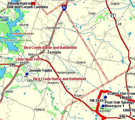
Marker Title: Bird Creek Battlefield
City: Temple
County: Bell
Year Marker Erected: 1936
Marker Location: In median at intersection of Adams and
S I-35 across from Church of Christ, Temple.
Marker Text: Named in honor of Captain John Bird who lost
his life here May 26, 1839 With only 34 Texas Rangers he met 240 Indians
at this point, and routed them.
Marker Title: Bird Creek Indian Battle
City: Temple
County: Bell
Year Marker Erected: 1936
Marker Location: At the 2000 blk. of Nugent (inside of
road), west of I-35 and just east of Bird Creek.
Marker Text: May 26, 1839 This marker commemorates the
death of captain John Bird Sergeant William Weaver Jesse E. Nash H.M.C. Hall Thomas Gay and the heroic and successful battle of a Ranger
force of 34 against 240 Indians. More
Some three miles southeast of present day Belton, Kickapoo's attacked
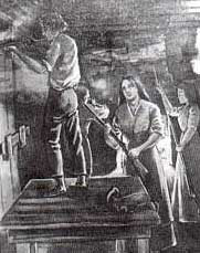
the home of Joseph Taylor on the night of November 12th, 1835.

"Heroic Defense of the Taylor Family" was originally
published in James DeShields' 1912 book, Border Wars of Texas.
The family held off the Indians and managed to kill two of the attackers.
At one point the mother threw a shovel of hot coals into the face of
an Indian who was peering through a hole in the wall. Two months after
the fight, their fourteen year old son Stephen Frazier joined Sterling
Robertson's Ranger company. Rangers arrived the day after the attack,
including George Chapman, who lived at the Taylor's home and later married
one of the Taylor daughters. She later recalled:
My late husband came to us at the home of Mr. Childers. He had been
to our house. The bodies of the two Indians were being eaten by the
hogs.
The Rangers cut the heads off of the dead warriors and stuck them on
poles as a warning to any other hostiles that should pass that way.
Marker Title: Little River Fort
City: Belton vicinity
County: Bell
Year Marker Erected: 1969
Marker Location: 2 miles north of Belton on IH-35 to roadside
park at Lampasas River bridge.
Marker Text: A stockade and blockhouse of the Republic
of Texas. Built in November, 1836, by a unit of some 20 Rangers under
Lt. George B. Erath (soldier-statesman for whom Erath County was named).
By Christmas they had erected 7 or 8 cabins, a blockhouse and a picket
stockade, which enclosed about 1/2 acre of land. A spring nearby supplied
water. Rations included an ear of corn daily, game, honey and a little
coffee. The Rangers withdrew about May, 1837. Later the fort was used
by settlers, hunters and adventurers. The remains of the structures
were removed, 1840s. (1969)
* items are taken directly from the book, Savage
Frontier, by Stephen L. Moore. |