Weatherford to Salesville |
|
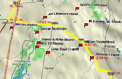
Fort Belknap Road
Follow Main St. north of the square to the red light
at the Exxon station. Turn left and follow 920 5.4 miles to the left
turn onto 1885, which continues northwest. This follows roughly the
same route as the original military road from Fort Worth to Fort Belknap. Details related to the mileage marked along the trail can be found in the tan box below.


Thanks to the discovery of gold in California, Fort
Worth was obsolete as a sentinel on the frontier almost before construction
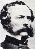
was finished. An army detachment under Captain
R.B. Marcy (pictured left) escorted the first large wagon
train of goldseekers from Fort Smith, Arkansas through the Rockies
on the Santa Fe Trail. Marcy's return route entered Texas through El Paso, skirting the western side of the Hill Country and Cross
Timbers and entering Indian territory north of Dallas at Fort Preston
on the Red. His return route, referred to as the Southern Route, California
or Marcy's Trail, was warmer, less mountainous and popular with gold
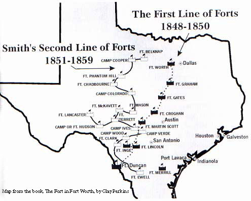
and adventure seekers. Soon a new line of forts was constructed to
protect the western bound traffic. Hwy. 254 roughly follows the military
road built to link Fort Worth to the army's new outpost.

Map from the book, The Fort in Fort Worth, by Clay Perkins
Originally the army intended to man the western forts
with infantry and keep the horse dragoons at the eastern line of forts.
This was based on the theory that marauders would be trapped between
the two forces and it was considerably cheaper to keep the horses
where there was plentiful grass and corn cultivation. However, even
though there were numerous alarms of pending large-scale Comanche
raids in North Texas, most all of the action happened around the Rio
Grande. The Comanches had a very profitable business providing badly
needed horses to the migrating goldseekers, and their profit margins
were high because they were stealing their inventory in Mexico. Since
the United States agreed to protect Mexico from Comanche raids as
part of its war settlement, the eastern forts were closed and many
of the troops were relocated to the border forts.
Soldiers relocated to the new western forts needed beef
and soon cow camps began to spring up near the Fort Worth to Fort
Belknap Road. Cow camps became ranches and after houses replaced tents,
families moved in to join the men.


