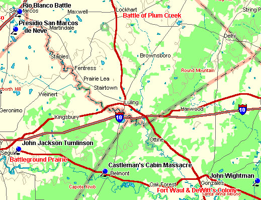
Plum Creek Leg
To the north are the beautiful counties of Comal
and Hays.
Marker Title: Battle of Plum Creek
City: Lockhart
County: Caldwell
Year Marker Erected: 1978
Marker Location: near intersection of US 183 and SH 142 in Lions
Park.
Marker Text: The harsh anti-Indian policies of President Mirabeau
B. Lamar and Mexican efforts to weaken the Republic of Texas stirred
Indian hostilities. Hatred increased after the Council House Fight in
San Antonio, March 19, 1840, where 12 Comanche chief were killed. After
regrouping and making plans for revenge, 600 Comanches and Kiowas, including
women and children, moved across central Texas in early August. They
raided Victoria and Linnville (120 mi. SE), a prosperous seaport. About
200 Texans met at Good's Crossing on Plum Creek under Major-General
Felix Huston (1800-1857) to stop the Indians. Adorned with their plunder
from Linnville, the war party stretched for miles across the prairie.
The Battle of Plum Creek, August 12, 1840, began on Comanche Flats (5.5
mi. SE) and proceeded to Kelley springs (2.5 mi. SW), with skirmishes
as far as present San Marcos and Kyle. Mathew Caldwell (1798-1842),
for whom Caldwell County was named, was injured in the Council House
fight but took part in this battle. Volunteers under Edward Burleson
(1793-1851) included 13 Tonkawa Indians, marked as Texan allies by white
armbands. Texan casualties were light while the Indians lost over 80
chiefs and warriors. This battle ended the Comanche penetration of settled
portions of Texas. More
One of the little settlements that would remain a centerpiece for
Indian troubles and revolution was Gonzales, the capital of Green
DeWitt's young Texas colony. The area of DeWitt's Colony as contracted
with the Mexican government included all of present Gonzales, Caldwell,
Guadalupe, and DeWitt Counties and portions of Lavaca, Wilson, and
Karnes Counties.
The peace in this area was shattered on July 2, 1826, when a party
of Indians attacked a group of pioneers, stealing their horses and
personal effects. Bazil Durbin was wounded by a rifle ball that drove
so deeply into his shoulder that it remained there for the next thirty-two
years of his life. The Indians next plundered the double log home
of James Kerr, where John Wightman had been left alone in charge of
the premises. Wightman was killed, mutilated, and had his scalp removed
by the Indians. The fear spread by this depredation was enough to
prevent the Gonzales area from being permanently settled again until
the spring of 1828.
Marker Title: Fort Waul
City: Gonzales
County: Gonzales
Year Marker Erected: 1988
Marker Location: US 183 R.O.W, .25 miles N of US 183 & 90
A Intersection.
Marker Text: Named for Confederate General Thomas N. Waul, Fort
Waul was built to defend inland Texas from possible Federal advances
up the Guadalupe River from the Gulf of Mexico, as well as to provide
protection for military supply trains. Construction of the earthen fortification
was overseen by Col. Albert Miller Lea, Confederate army engineer. Begun
in late 1863, the fort was partly built by slave labor and measured
approximately 250 by 750 feet. Surviving records do not indicate whether
the fort was ever actually completed.
Marker Title: Kerr's Settlement
City: Gonzales
County: Gonzales
Year Marker Erected: 1964
Marker Location: FM 146 W side of Kerr Creek, near E. city limits,
(in gazebo structure)
Marker Text: --
15 mi. W of Gonzales April 15th, 1835. From the book, Savage
Frontier, by Stephen L. Moore:
The campground was ominously quiet as the first rays of sunlight
filtered through the trees along Sandies Creek. The dawn air was cool
on the mid-April morning in South Texas. The tranquility was violently
interrupted by the sudden report of rifles and resounding war whoops
as more than sixty Comanche Indians descended on the scene.
The men of the camp scrambled to make a stand. Improvising breastworks
of carts, packsaddles, and trading goods, the besieged fired back
at the howling Indians who outnumbered them by upwards of six to one.
The contest was fierce, but it was over before it had begun.
From a small porthole type window in his pioneer cabin several hundred
yards away, John Castleman could only watch the massacre in anguish.
He was frustrated that he could not assist the besieged and that they
had not heeded his advice.
His gut instinct was to open fire with his rifle, however futile
the effort may prove to be. Only the pleading of Castleman's wife
restrained him. The first shot he fired would only ensure that he,
his wife, and his children would also be slaughtered. Even still,
it was difficult to watch as others died before him.
Castleman and his pioneer family had become bystanders to a bloody
Indian depredation in south central Texas. It was April 1835 when
the Indians descended near his place and slaughtered a party of traders.
John Castleman, a backwoodsman from Missouri, had settled with his
wife, four children, and his wife's mother in the autumn of 1833 fifteen
miles west of Gonzales. His cabin often served as a place of refuge
for travelers moving down the San Antonio Road from Gonzales. Castleman's
place was located in present Gonzales on Sandies Creek, a good watering
hole. Indians were known to be about the area, and they had even killed
his four dogs in one attempt to steal Castleman's horses.
...The traders declined the offer to use Castleman's cabin, choosing
to retire for the night near the waterhole. The Indians attacked these
traders right at daylight, the yelling from which had awakened Castleman.
The traders fired back and continued to hold their ground for some
four hours while the Indians circled them. The attackers slowly tightened
their circle as the morning sun rose, falling back temporarily whenever
the traders managed to inflict damage on their own numbers.
The traders suffered losses and drew to a desperate point. The furious
Comanches finally took advantage of their enemies' desperation and
made an all-out onslaught from three sides. They succeeded in drawing
the fire of the party simultaneously and left them momentarily unloaded.
During this brief instant, the Indians rushed in with victorious war
whoops and fell upon the traders in hand-to-hand combat.
Raiding to acquire fine stock and other goods became a ruthless sport
to the Comanche (translatable as "the real people" in Indian
tongue) as settlement of Texas began to encroach upon the hunting
lands the Indians had long claimed. By 1830 the Indian population
in the territory of Texas was perhaps fifteen thousand compared to
about seventeen thousand settlers of Anglo-European, Mexican national,
and black origin. In combat with early settlers, the Comanche warriors
had learned to exploit any advantage a battle might offer them, such
as lengthy time required to reload weapons in the case of the French
and Mexican traders. The determined Indians could accurately fire
a half dozen arrows in the time it took an opponent to reload his
rifle a single time. The battlewise Comanches forced the traders to
discharge all their weapons at once before moving in to slaughter
the men before they could reload.
This last terrific charge was witnessed by Castleman from his window,
and he immediately realized that it was all over for the poor traders.
The victims were brutally mutilated and scalped. The Comanches stayed
long enough to dispose of their own dead, round up the traders' mules,
and collect all of the booty that was desired. As they slowly rode
past his house single file, Castleman counted eighty surviving warriors,
each shaking his shield or lance at the house as they passed.
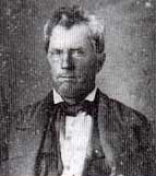 |
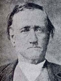 |
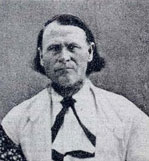 |
Col. Edward Burleson |
James Milford Day |
James Wilson Nichols |
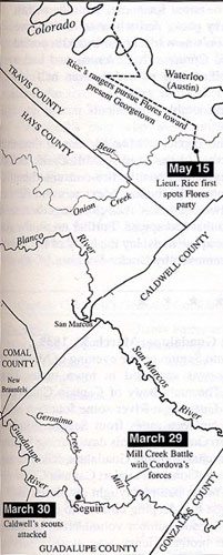
James Milford Day, pictured above, one of Guadalupe County's earliest settlers, was seriously wounded in a gun battle with Cordova's rebels on March 30, 1839.
Ranger Jim Nichols, also above, wrote of Day's suffering:
We taken them home but Milford had a lingering hard and painful time before he recovered, and after he was thought to be well his hip rose and several pieces of bone worked out. Then for many years he had to undergo the same pain and suffering from his hip rising and pieces of slivered bones working out. He finally recovered after years of pain and suffering, but it made a cripple of him for life. But he is still living at this writing and limping around on one short leg and has seen as many ups and down since that time as any man of his age.
Marker Title: Battleground Prairie
City: Seguin
County: Guadalupe
Year Marker Erected: 1936
Marker Location: from Seguin, take US 90A East five miles to
marker site.
Marker Text: Where 80 volunteers commanded by General Edward
Burleson defeated Vicente Cordova and 75 Mexicans, Indians and Negroes,
March 29, 1839, and drove them from Texas, ending the "Cordova
Rebellion." 25 of the enemy were killed. Many volunteers were wounded,
but none fatally.
John Jackson Tumlinson, who had requested the need for a ranger-type
system in January 182, was killed on July 6, 1823, by a band of Indians
near the present town of Seguin in the Colorado settlement. Tumlinson
and a companion, aide Joseph Newman, had been en route to San Antonio
to secure ammunition requested by Moses Morrison's men when he was
killed by Karankawa and Huaco Indians.
John Jackson Tumlinson's son, John Jackson Tumlinson Jr., later a
respected ranger captain, collected a posse and led them against a
band of thirteen Huaco (Waco) Indians who had camped above the present
town of Columbus. The posse leader's teenage brother, Joseph Tumlinson,
acted as a scout for this unit and managed to kill the first Indian
when the Texans surprised the Waco camp. Captain Tumlinson's posse
killed all but one of the Indians.
Presidio San Marcos de Neve was founded in the early nineteenth century
four miles below present-day San Marcos, where the Old San Antonio Road
crossed the San Marcos River. A flood in June of 1808 nearly wiped out
the community. The colony held on for several years, but harassment
by Comanche and Tonkawa Indians forced settlers to abandon it in 1812.
Archeologists recently have discovered ruins, which are probably of
the presidio and community. The location of these ruins is still being
kept a secret.
Castleman gathered his family and hurried to Gonzales where volunteers
were raised for pursuit. Just outside of San Marcos on bluff of Blanco
River, April 18th, 1835, Captain Bartlett D. McClure's posse of about
thirty men found the murderers. The posse split into two parties, one
circling around while the other attacked. John Castleman was among those
who killed a few warriors during the advance. Andrew Sowell Sr. was
part of the group of volunteers waiting behind the Indians in ambush.
His nephew, A.J. Sowell, later wrote:
Several shots were fired, and a third Indian had his bow stick shot
in two while in the act of discharging an arrow. Andrew Sowell attempted
to fire with a flintlock rifle, but it flashed in the pan. He had
stopped up the touch-hole to keep the powder dry in the fog, and had
forgotten to take it out. The other Indians now ran back towards the
river, yelling loudly. By this time most of the men had gotten clear
of the brush and charged with McClure across the open ground.
...Captain McClure's volunteer forces pursued the Indians to the
Blanco River, where the fighting became more general. More of the
fifty-odd Comanches were killed as they tried to cross the water with
their stolen goods. Andrew Sowell shot and killed on Indian as he
tried in vain to climb a steep bank on the far side. In the end, they
left much of their spoils behind and moved swiftly from the area.
The whites chose not to cross the river and continue their pursuit.
They were fortunate to have not had any man killed or any serious
injuries sustained.
|


