|
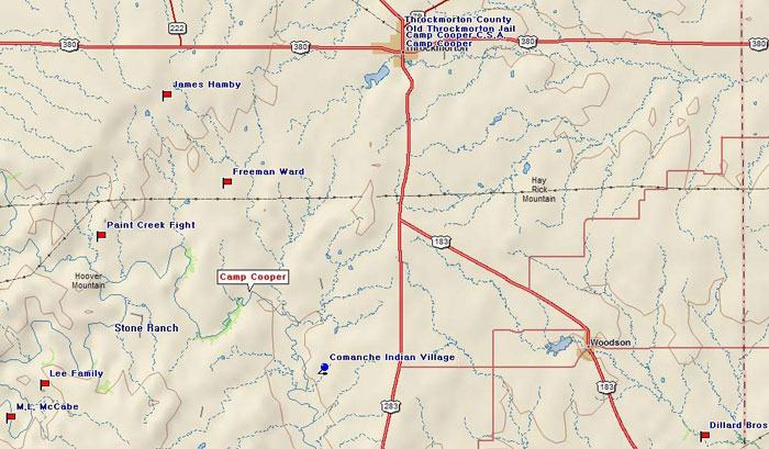
Marker Title: Camp Cooper, C.S.A.
Address: US 380 & US 183/283
City: Throckmorton
Year Marker Erected: 1963
Marker Location: Courthouse Square, intersection of US 380 & US
183/283, Throckmorton.
Marker Text: Located 17 miles south. Surrendered by U.S. at outbreak
Civil War. Used as Confederate frontier outpost on the defense line
from Red River to the Rio Grande. Manned by Texas Cavalry, mounted riflemen,
Rangers. Constant patrol and scouting maintained guard against Indian
raids, Union invasion, marauding deserters, "Jayhawkers".
Always short on food, supplies, ammunition, and horses these troops
fought the Comanches in numerous engagements while effectively protecting
supply train and pioneer families along edge of settlement. A Memorial
to Texans Who Served the Confederacy Erected by the State of Texas 1963.
Marker Title: Site of Camp Cooper
Address: RR 2528, off of US 283
City: Throckmorton
Year Marker Erected: 1936
Marker Location: From Throckmorton, take US 283 South 8 mi to RR 2528,
& go west 7 miles.
Marker Text: Established by Major W.J. Hardee, 2nd U.S. Cavalry, on
January 3, 1856 for the purpose of defending the frontier against Comanche
Indians. Named in honor of Samuel Cooper, Adjutant General, U.S. Army.
Home of General Robert E. Lee for nineteen months, 1856-1857. From this
post the Cimarron Expedition set out, October 1, 1859. Abandoned February
21, 1861.
Marker Title: Comanche Indian Village
Address: On County Road, SW of Throckmorton
City: Throckmorton
Year Marker Erected: 1936
Marker Location: From Throckmorton, take US 283/183 South about 10 mi.,
then go west on County Rd. about 2 miles to fork-in-road & continue
on SW fork about 3 mi through cultivated field.
Marker Title: Throckmorton County
Address: US 283 & SH 79
City: Throckmorton
Year Marker Erected: 1936
Marker Location: N. City limits US 283/SH79 Jct. on US 283 side; Throckmorton.
Marker Text: Formed from Fannin and Bosque counties. Created January
13, 1858. Organized March 18, 1879. Named in Honor of Dr. William Edward
Throckmorton, 1795-1843, a revolutionary soldier. Father of James Webb
Throckmorton, who became Governor of Texas in 1866. County seat, Throckmorton
Marker Title: Old Throckmorton Jail
Address: S Eagle & W Chestnut St.
City: Throckmorton
Marker Location: Corner of S. Eagle & W. Chestnut, Throckmorton.
|