|
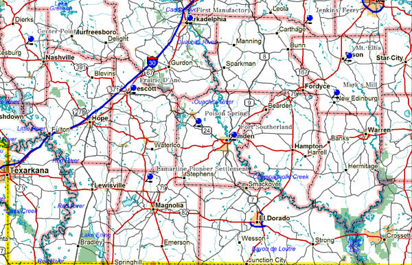
Near this spot in 1837 Robert Messer built the first house in Center Point. A few years later John Russey opened the first store. Center Point acquired its name and post office in 1848, and became an incorporated town in 1859. Held by the Confederates throughout the Civil War, Center Point was raided by Carpetbagger State Militia in 1868 because of its southern sympathies. It was the first county seat of Howard County from 1873 to 1905. On February 12, 1900 Jeff Davis opened his campaign for Governor of Arkansas with an address here.
Howard County, Center Point
Indians in Primeval times, DeSoto in 1541, Pioneers in the 1800s and Confederates during the Civil War obtained salt from the creek and old well here. John Hemphill in 1812 opened one of the first manufactories in Arkansas - a salt refinery.
Clark County Hwy 8, one mile east of Arkadelphia
Fort Southerland was one of five forts established in the Camden area in 1861 and occupied by Confederate troops under Gen. Sterling Price in 1862. This fortification served to protect the Bradley Perry River crossing and the approach to Camden from the El Dorado area. Fort Southerland was the only fortification in the Camden area to be fired upon by Confederate troops. Federal troops commanded by Gen. Frederick Steele occupied Camden and Fort Southerland from April 15, 1864 to April 25, 1864 after luring the Confederate command from the area in a series of skirmishes to the west. It was during this occupation by Federal troops that Confederate forces under the command of Gen. Sterling Price fired on Fort Southerland from the Two Bayou area south of the fort. This was a short engagement and served only to harass Federal troops. Ultimately, the campaign failed from breakdown in supply and Federals withdrew and on April 26, 1864 Confederates reoccupied Camden and Fort Southerland.
Quachita County, Fort Southerland, Camden.
One of the oldest settlements in Columbia County. Here Colonel John Dockery had his plantation and home. Here T.P. Dockery, who became a general in the War Between the States was born and reared. The Caddo Indian Trail from Camden on the Quachita to Miller's Bluff on Red River passed by here. Other Indian trails centered here. Andrew Jackson cut out these trails and built a military road in 1825 from New Orleans to the frontier forts of Townson and Fort Smith.
Columbia County, Highway 19, 3 miles north of Waldo
Here on April 18, 1864 a Union forage train of 200 wagons escorted by 1170 men was attacked and captured by Confederate troops commanded by Generals John. S. Marmaduke and Samuel B. Maxey. The wagons were loaded with corn for the Union army of Gen. Frederick Steele encamped at Camden. Loss of these supplies helped to hasten Steele's retreat to his base in Little Rock. The Union loss at Poison Springs was 201 men killed, wounded and missing. Confederate casualties totaled 114 men.
Quachita County 3 miles west on Poison Springs Road on highway 76 near Chidester in Ouachita County
Located at Prescott in Nevada County, most of it is still pasture land and is all private property. Visitors can learn about the battle at a museum in Prescott. |
