
Marker Title: Angelina River
City: Linwood
County: Cherokee
Year Marker Erected: 1965
Marker Location: about 3 miles east of Linwood on State Hwy 21
Marker Text: Early Texas artery of travel and transportation.
Ran through lands of civilized Indians whose word "Tejas",
for friend, gave name to northern part of New Spain, then to the Republic
and State of Texas. Here in 1690, Spanish explorers and missionaries
found a young girl eager to learn Christianity. For her sweet disposition,
she was called Angelina. Her name soon was used for the river where
she lived. Though French and Spaniards were enemies, Angelina befriended
all, and for years acted as interpreter. Angelina River by 1799 was
route for settlers to come from the coast to East Texas. It was crossed
by the Camino Real (King's Highway to Mexico) and by Smugglers' Road,
for those dodging tax collectors. In the 1830s, John Durst promoted
on the Angelina, just south of here, a port for shipping cotton to New
Orleans and receiving merchandise in return. Other Texas rivers named
by Spaniards include the Blanco, Brazos (river of the arms of God),
colorado, Concho, Comal (A Pan), Frio, Guadalupe, Lavaca, Llano, Medina,
Navidad, Navasota, Neches, Nueces, Pedernales, Pecos, Rio Grande, San
Antonio, San Gabriel, Trinity and San Jacinto. Anglo-American names
for streams include Canadian, Pease, Red and Devil's River.
Marker Title: Ellis P. Bean
City: Alto
County: Cherokee
Year Marker Erected: 1999
Marker Location: 2 mi. E of Alto on SH 21 at CR
Marker Text: (Peter Ellis Bean) (June 8, 1783 - October 3, 1846)
Born in Tennessee, Ellis P. Bean came to Texas with Philip Nolan's mustang
hunters in 1800. He was captured by Spanish troops in 1801, and taken
to Mexico as a prisoner. In 1810 he was freed in exchange for service
to the Royalist Army, but he quickly deserted to the rebels under Morelos.
Fifteen years later, Bean returned to the U. S. as a Mexican colonel
to seek aid for the rebel cause. He joined Andrew Jackson's army at
the Battle of New Orleans, but returned to Mexico within the year. In
1816 he barely escaped the Royalists by leaving his wife to flee to
the U. S. He married a Tennessean in 1818. They moved to Texas in 1823,
where Bean served Mexico as an Indian agent. After Texas independence,
Bean made his home near this site. He disappeared in 1843 to return
to Mexico, dying in the home of his first wife in 1846. (1999)
Marker Title: Candice Midkiff Bean
City: Linwood
County:
Year Marker Erected: 1936
Marker Location: Selman-Roark Cemetery on State Hwy. 21 in Linwood.
Marker Text: Wife of Peter Ellis Bean born near Nashville, Tenn.
in 1802. Died near Douglass, Texas in December 1848. One of those pioneer
women who braved the Indian menace and rocked the cradle of Texas liberty.
Marker Title: Chief Samuel Benge
City: Jacksonville vicinity
County: Cherokee
Year Marker Erected: 2001
Marker Location: 4.2 miles north of Jacksonville on US 69, then
5 miles west on FM 855 and 2 miles north on FM 2137 to CR 3601.
Marker Text: A leader of the Cherokee Indians in Texas during
the 1830s, Samuel Benge was present at the negotiations with General
Sam Houston, John Cameron and John Forbes in early 1836 to secure a
treaty with the Cherokee in return for neutrality during the imminent
war for independence from Mexico. As a condition of the resulting Houston-Forbes
Treaty, the Cherokee were to occupy specific lands in east Texas, and
Chief Benge, a signer of the treaty, was required to move east across
the Neches River into what is now Cherokee County. The Cherokee upheld
their part of the treaty during the war, but the Republic of Texas senate
later nullified the treaty, a step toward the ultimate removal of the
Cherokees from Texas. (2001)
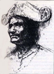
Chief John Bowles, Leader of the Texas Cherokees
Picture from the book, Savage Frontier II, by Stephen L. Moore
Marker Title: Chief Bowles' Last Homesite
City: Alto vicinity
County: Cherokee
Year Marker Erected: 2001
Marker Location: 2 miles north of Alto on US 69 to CR 2405
Marker Text: In 1836, General Sam Houston negotiated a treaty
with the Cherokees in Texas allowing possession of the lands they occupied
in east Texas. The leading figure among the Cherokees at that time was
Duwali (also known as Bowl, Chief Bowles and Bold Hunter). After the
Texas Revolution, the Senate of the Republic of Texas declared the treaty
invalid. Near this site in 1839, Chief Bowles learned of Texas President
Mirabeau B. Lamar's orders to remove the Cherokee from Texas. Bowl mobilized
his people to resist the expulsion, but they were defeated and the chief
was killed at the Battle of the Neches on July 16, 1839, in what is
now Van Zandt County. (2001) More
Marker Title: Box's Fort
City: Alto
County: Cherokee
Year Marker Erected: 2000
Marker Location: 9 mi. W of Alto on SH 294
Marker Text: John M. and Sally Box, along with John's brother Stephen F. and his wife Keziah Box and their families, came to Texas from Alabama in 1834. John and Sally's son, Roland W. Box, and his wife Mary Hallmark Box purchased 1/3 of the Stephen Burnham land grant and built a log fort on a hill near its northern boundary. Within the enclosure they built a log house and a dugout, and Box's Fort became the center of a settlement as the extended Box families made their own homes in and near the fort. John A., Stillwell, Thomas G., and Nelson Box and their cousins Samuel C. and James E. Box fought in the Texas revolution. The home of John A. and Letty T. Box was a post office called Box's Creek from 1851 to 1866. Over time, several churches and stores operated in the vicinity, but by 1900 Box's Fort no longer appeared on area maps. (2000)
Museum Name: Caddoan Mounds State Historic Park
Mailing Address: Rt. 2, Box 850
City: Alto
Zip Code: 75925
Street Address: Highway 21 W. - 6 miles W. of Alto
Area Code: 409
Phone: 858-3218
County: Cherokee
Marker Title: Ben Cannon Ferry
City: Maydelle
County: Cherokee
Marker Location: 6 miles west on US 84 right-of-way at Neches
River, Maydelle.
Marker Text: Native American and early Anglo settlers in this
region forded the Neches River at this site, called Duty Crossing for
early settler Richard Duty. A significant link in the history of transportation
across the river, the Ben Cannon Ferry is first documented in Cherokee
County Commissioners court records in 1848. Pioneer settler Ben Canon
operated the Ferry until 1851. A toll bridge operated north of the ferry
site from 1854 to 1924. The route of the Texas State Railroad crosses
the Neches just north of the ferry site.
Marker Title: Confederate Gun Factory
City: Rusk
County: Cherokee
Year Marker Erected: 1936
Marker Location: .25 miles west of courthouse on 6th (US 84)
Marker Text: Built in 1862 by John L. Whitescarver, William H.
Campbell and Benjamin F. Campbell. When unable to secure materials and
tools for the manufacture of rifles, Colt-model pistols were made. A
number of Negroes were employed.
Marker Title: Confederate Training Camp
City: Rusk
County: Cherokee
Year Marker Erected: 1984
Marker Location: Old Crockett Road
Marker Text: During the Civil War this area along the road from
Rusk to Crockett served as a training camp for Confederate soldiers.
Located in a bare field with an available water supply from the nearby
Pryor Branch, Camp Rusk was used for training new recruits as well as
for reorganizing and equipping veteran units. Several units that spent
time here went on to serve with distinction in such battles as Mansfield
and Glorietta Pass. The training camp was occupied by Union soldiers
after the war ended and was abandoned once the occupation period was
over.
Marker Title: Cook's Fort
City: Rusk
County: Cherokee
Year Marker Erected: 1936
Marker Location: about 3 miles south of Rusk on FM 241.
Marker Text: Named in honor of Joseph T. Cook; native of North
Carolina; Early settler in Nacogdoches; Owner of land on which a military
company under Captain Black built a fort never attacked by Indians;
On adjacent land, James Cook built a store and blacksmith shop; About
them a village grew up; Population in 1846, 250; After establishment
of Rusk, inhabitants moved there.
Marker Title: Cuney
City: Cuney
County: Cherokee
Year Marker Erected: 1982
Marker Location: US 175 and FM 3327.
Marker Text: The earliest area settlers were Andrew "Andy"
Bragg and Nelson Sneed, black farmers who moved here in 1870. Former
slaves, they were later joined by other freedmen farmers, landowners
and tradesmen. The settlement that resulted was know as Andy. In 1916
former Palestine banker H. L. Price moved to the community. Encouraged
by the area's potential as a commercial and agricultural center for
blacks, he directed formation of the Andy Real Estate Company. He was
joined in the operation by his son Cuney Price, W.D. Thomas, J.Z.
Thomas, W.A. Hall, and John Bragg. The firm renamed the town Cuney
for Price's son, who was named for the prominent black business and
political leader Norris Wright Cuney. Statewide promotion of the town
resulted in rapid growth for Cuney, which soon included churches, stores,
gins, sawmills, a railroad station, a hotel and a baseball team. Nelson
Sneed donated land for the establishment of community schools. Cuney
declined after World War I as agricultural prices decreased and area
residents moved to other towns for work. Today it serves as a reminder
of the area's pioneers and the significant contribution they made to
the heritage of Texas' black community. (1982)
Marker Title: Delaware Indian Village
City: Alto
County: Cherokee
Year Marker Erected: 1936
Marker Location: About 2.5 miles west of Alto on SH 21.
Marker Text: Noted as interpreters and messengers of peace,
the Delawares were chiefly instrumental in bringing other tribes to
the General Treaty at Bird's Fort (in the present county of Tarrant)
in 1843.
Marker Title: Hasinai
City: Alto
County: Cherokee
Marker Location: 2 miles SW of Alto on Hwy 21.
Marker Text: In the present county of Cherokee was the home of
the exalted Grand Xinesi-Chief Priest and Custodian of the Sacred Fire
of the Hasinai Confederacy of Indians. If fire was allowed to die out,
it was his duty to carry more fire with proper ceremony to their homes
to be rekindled. It was to the Hasinai -- the principal tribe of this
Confederacy -- that the word "Texas" was generally applied
Marker Title: Homer-Alto Road
City: Alto
County: Cherokee
Year Marker Erected: 1999
Marker Location: intersection of US 69 & FM 1911, 10.5
mi. S of Alto.
Marker Text: As the population increased in Angelina and
Cherokee counties in the 1860s, a formal system of roads began to take
shape. Until that time, roads were usually forged by farmers and other
pioneers carrying goods to market or traveling to new homes, as in other
areas of Texas. Construction of a road from Homer (at that time Angelina
County seat) to Alto began in 1860. The survey crew followed buffalo and
Indian trails to determine the best route for the new road. Once open,
it was the official mail route from Homer to Alto, and then on to Rusk,
the Cherokee County seat. It led through a community known as Denman Springs
until 1882 when Lufkin was created there and the road became Denman Avenue.
The main part of the Homer-Alto Road became State Highway 40 in the 1930s
and later U.S. Highway 69. (1999)
Marker Title: Killough Massacre
City: Jacksonville
County: Cherokee
Year Marker Erected: 1965
Marker Location: 7 miles northwest of Jacksonville on US 69,
north to FM 855 then southeast on CR 3405 to monument site on CR 3411.
Marker Text: In this area, on October 5, 1838, the Killough, Wood and
Williams families were attacked by hostile Indians and Mexicans: 18
were either killed of carried away; 8 escaped on horseback; 3 women
with a baby fled on foot and were saved on third day by a friendly Indian.
Was biggest Indian depredation of East Texas. Bodies of the victims
found were buried here.
General Rusk ordered East Texas captains to raise new Ranger companies. The worst massacre suffered in the new settlements occurred on the heels of the order spurring the troops to action.
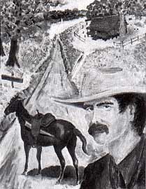
Elisha Clapp
Elias Vansickle escaped Cordova's rebels and reported in January, 1839, that Mexican troops and East Texas Indians planned immediate attacks on the white settlements and further confirmed a suspected Cherokee had participated in the massacre.
Stephen L. Moore, Savage Frontier II
Marker Title: Site of Lacy's Fort
City: Alto
County: Cherokee
Year Marker Erected: 1936
Marker Location: About 2.5 miles West of Alto on SH 21.
Marker Text: Built before 1835 as a home and trading post by
Martin Lacy, Indian agent for the Mexican government. Used as a place
of refuge after the massacre of the Killough family, October 5, 1838.
Marker Title: Little Bean's Cherokee
Address: 3 mi. W on US 84 at FM 347
City: Rusk
County: Cherokee
Year Marker Erected: 1991
Marker Location: 3 miles west of Rusk on US 84 at FM 347
Marker Text: In the winter of 1819-1820 Chief John Bowles
led about sixty Cherokee families from Arkansas to East Texas. Near
this site a small settlement was established by a leader named Little
Bean. They remained until 1839, when the Republic of Texas government
forced the tribe to move to Oklahoma. The land later was opened to Anglo
settlers. Early owners of the Indian village were Reza J. Banks and
Lewis Rogers. Little Bean, who died in 1839, is thought to be buried
in the vicinity of the village.
Marker Title: Lone Star
City: New Summerfield
County: Cherokee
Year Marker Erected: 1985
Marker Location: 4 miles southwest of New Summerfield
on FM 235.
Marker Text: The ante bellum community of Lone Star, a
center of trade, education and culture in the 1880s, experienced its
greatest growth after the Civil War. Known first as "Skin Tight,"
it was named Lone Star when a post office opened in 1883. The town once
had several businesses, a public school, four churches, two lodges and
the Lone Star Institute. The town began to decline after a disastrous
fire in 1893. Decline continued when the T & N O Railroad bypassed
Lone Star. Hope for the community's revival died when two oil field
discoveries did not prove to be profitable.
Marker Title: Love's Lookout
City: Jacksonville
County: Cherokee
Year Marker Erected: 1978
Marker Location: Roadside park on US 69, 4 miles north of Jacksonville.
Marker Text: On this nine mile long ridge there are two historic
lookout points which command a view of 30 to 35 miles. Between this
site, with an elevation of 713 ft., and Point Lookout (1/4 mi. NW),
lies a narrow valley. An Indian trail and later a pioneer road crossed
this valley. The pass became known as McKee's Gap in 1846, after Thomas
McKee led a group of Presbyterians here form Tennessee and began the
town of Larissa (3.5 mi. nw). Named by McKee's son the Rev. T.N. McKee,
the village flourished as the location of Larissa College from the 1850s
until the 1870s. Point Lookout was a popular recreational area for citizens
of Larissa until the railroad bypassed the town and it declined. Around
the turn of the century, John Wesley Love (1858-1925) bought this land
and developed a 600-acre peach orchard. Known as Love's Lookout, the
scenic point was used for outings by area residents. After Love's death,
his family gave 22.22 acres, including the lookout site, to the state
for a park. The City of Jacksonville bought 25 adjoining acres and developed
both tracts as a WPA project. J.L. Brown (1866-1944) and Jewel Newton
Brown (1873-1966), former Larissa residents, gave the city 122 acres
next to the park in 1940 in tribute to pioneers of Larissa.
Marker Title: Mound Prairie
Address: SH 21
City: Alto
County: Cherokee
Year Marker Erected: 1969
Marker Location: 8 miles west of Alto on SH 2, just past Caddo
Mounds State Park.
Marker Text: Bulging out of the earth a few yards form this point,
three prehistoric Indian mounds interrupt the prevailing flat terrain.
Long overgrown with grass, the mounds and adjacent village (covering
about 100 acres) constitute one of the major aboriginal sites in North
America. From about 500 to 1100 A.D., Caddoan Indians inhabited the
village, which lay near the southwest edge of a great mound-building
culture. Called "Mississippian," this culture once flourished
throughout the present eastern United States. Excavations during 1939-41
and 1968-69 showed two of the mounds to have had ceremonial purposes.
One may have been capped with bright yellow clay and both apparently
supported temples. The tallest mound (about 20 feet) revealed several
major burials. The village, surrounding the mounds but not settled before
they were built, contained many round houses that probably resembled
giant bee hives. Thousands of pot fragments, some pipes, charred corn
cobs and nuts, and flint points were found in the area. Centuries after
its abandonment by the Indians, this region was again a center of civilization
when, in 1690, the first Spanish mission in East Texas was built nearby
to minister to the Neches Indians.
Marker Title: Neches Indian Village
City: Alto
County: Cherokee
Year Marker Erected: 1936
Marker Location: 8 miles west of Alto on SH 21 just past Caddo
Mounds State Park.
Marker Text: Here at the opening of the 18th century stood a
village of the Neches Indians. Their name was given to the river and
later to a mission, San Francisco de los Neches, established nearby.
With the Cherokees, the Neches Indians were expelled from Texas in 1839.
Marker Title: Old Neches Saline Road
Address: US 175
City: Jacksonville
County: Cherokee
Year Marker Erected: 1970
Marker Location: US 175, 2 miles northwest of Jacksonville.
Marker Text: Originally an Indian trail. Used in 1765 by the
Spanish priest Calahorra on an Indian peace mission. Gained importance,
1820s, for use in hauling salt from Neches Saline to Nacogdoches. Survivors
of the Killough family massacre of 1838 fled via the road to Fort Lacy.
The Texas Army used it en route to fight Mexican rebel Cordova in 1838
and in Cherokee War, 1839. Some of Kentucky volunteers went this way
to the Mexican War, 1846. After Indian wars, road brought in many settlers.
Jacksonville, Dialville and Larissa grew up along its path.
Marker Title: Zebulon Pike Campsite
City: Alto
County: Cherokee
Year Marker Erected: 1982
Marker Location: 7 miles west of Alto at Caddo Mounds State Park.
Marker Text: In 1807, under commission from Gen. James Wilkinson,
Governor of the Louisiana Territory, Lt. Zebulon Pike led an expedition
to explore the headwaters of the Arkansas and Red Rivers and to report
on Spanish settlements in the New Mexico area. Heading south from present
Colorado, where the party saw the mountain later named Pike's Peak for
the expedition's leader, they were arrested by Spanish authorities.
Under escort back to the United States, the party camped near this site
on June 24, 1807. The Pike expedition furnished an important account
of Spanish Texas and New Mexico.
Marker Title: Prisoner of War Compound C.S.A.
County: Cherokee
Year Marker Erected: 1965
Marker Location: 2 miles south of Rusk on FM 241.
Marker Text: Prisoner of War Compound at this site housed some
of the more than 3,000 Federals captured at Mansfield, LA., on April
8, 1864, in Red River campaign to prevent Federal invasion of Texas.
Camp Ford, at Tyler, was largest P.O.W. camp west of the Mississippi.
Texas had two others, at Hempstead, Waller County, and Camp Verde, Kerr
County.

Possibly the earliest settlement fort in Texas, built around 1833 in northeastern Houston County by Reuben Brown.
|